
Environmental screening
Flood and nature protection for German land
Water and nature designations sit on top of planning law and can stop a project that the development plan allows. How to screen a parcel before making an offer.
On this page
Two layers above the planning map
A development plan says what may be built. Water law and nature law say where it may not be, and they operate independently of the plan. A parcel zoned for housing that lies in a designated flood area, or carries a protected biotope, may still be unbuildable because those separate rules prevail.
Both layers are mapped and both are public. Screening them takes an evening with the state portals and costs nothing, and it belongs before the offer rather than after the architect. Federal law defines the core water and nature prohibitions, state law administers the mapped designations, and the municipality applies any local tree-protection by-law. What follows is the order to do it in and what each finding means in practice.
- § 76 / § 78 WHGDesignated area: building ban, narrow exception
- § 78b WHGRisk area: adapted construction
- § 77 WHGReserved area: planning safeguard
Source: WHG §§ 76, 77, 78 and 78b; checked August 2026
Designated flood areas, and what they forbid
§ 76 WHG requires areas that would be flooded by a statistically hundred-year event to be designated as Überschwemmungsgebiete. Inside a designated area, § 78 WHG prohibits the adoption of new development plans and the construction or extension of buildings, among other things.
Prohibited does not mean impossible. The same section allows the water authority to permit a building by way of exception where a list of conditions is met, including that flood storage is not lost, that water levels and discharge are not adversely affected, that existing flood protection is not impaired and that the building is flood-resistant. Getting there needs a hydraulic argument, a designer who has done it before and time, and the answer can be no.
Screen the water and nature layers first. A GrundCheck preflight report puts the parcel on the map with its surroundings, which is where the flood and protection questions become concrete. Check a parcel.
Risk areas and the space kept free
Two neighbouring categories cause confusion. Risikogebiete under § 78b WHG lie outside designated flood areas but can still be flooded by an extreme event, and they carry lighter requirements rather than a prohibition. Areas kept free for future flood protection under § 77 WHG are a planning reservation rather than a ban on the ground.
The practical difference for a buyer is the strength of the answer. Inside a designated area the starting point is a prohibition with a narrow exception. In a risk area the starting point is a duty to build sensibly, which usually means raised floor levels, no habitable basement, and materials that survive being wet. Both belong in the price; only one of them can end a project.
Insurance, and the question the bank will ask
Standard building insurance in Germany does not cover flood damage. Elementarschadenversicherung is a separate cover, and insurers price it by a national zoning system that runs from the lowest risk class to the highest. In the top class the cover can be expensive, restricted or unavailable.
Lenders know this. A plot where flood cover cannot be obtained is a plot where the security is worth less, and the financing conversation gets harder. Ask an insurer for an indicative answer on the address before completing, not afterwards. It is a five-minute enquiry that occasionally saves a purchase from happening at all.
Where to look it up
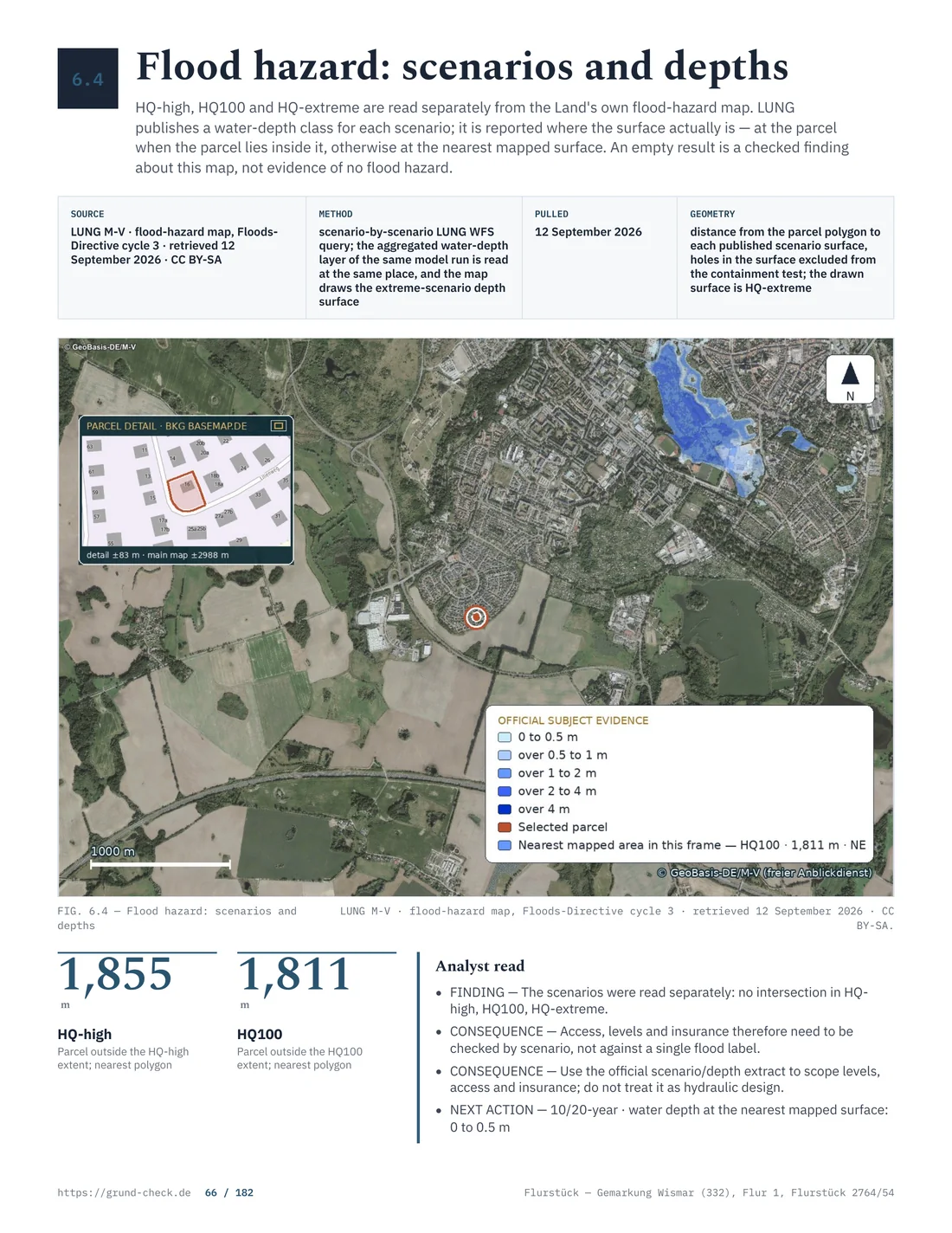
The state publishes its water and nature layers openly. The state geoportal and the state cadastral viewer carry the mapped designations, and the Landesamt für Umwelt holds the flood hazard and flood risk maps together with the underlying documents.
Read three things off them. Whether the parcel touches a designated flood area or a risk area, and where the boundary runs relative to the buildable part. Whether it lies in or beside a protected area. And what the water level in an extreme event would be at that spot, since the difference between a metre of standing water and ten centimetres in a corner of the garden is the difference between a project and a nuisance.
Protected areas, from strict to advisory
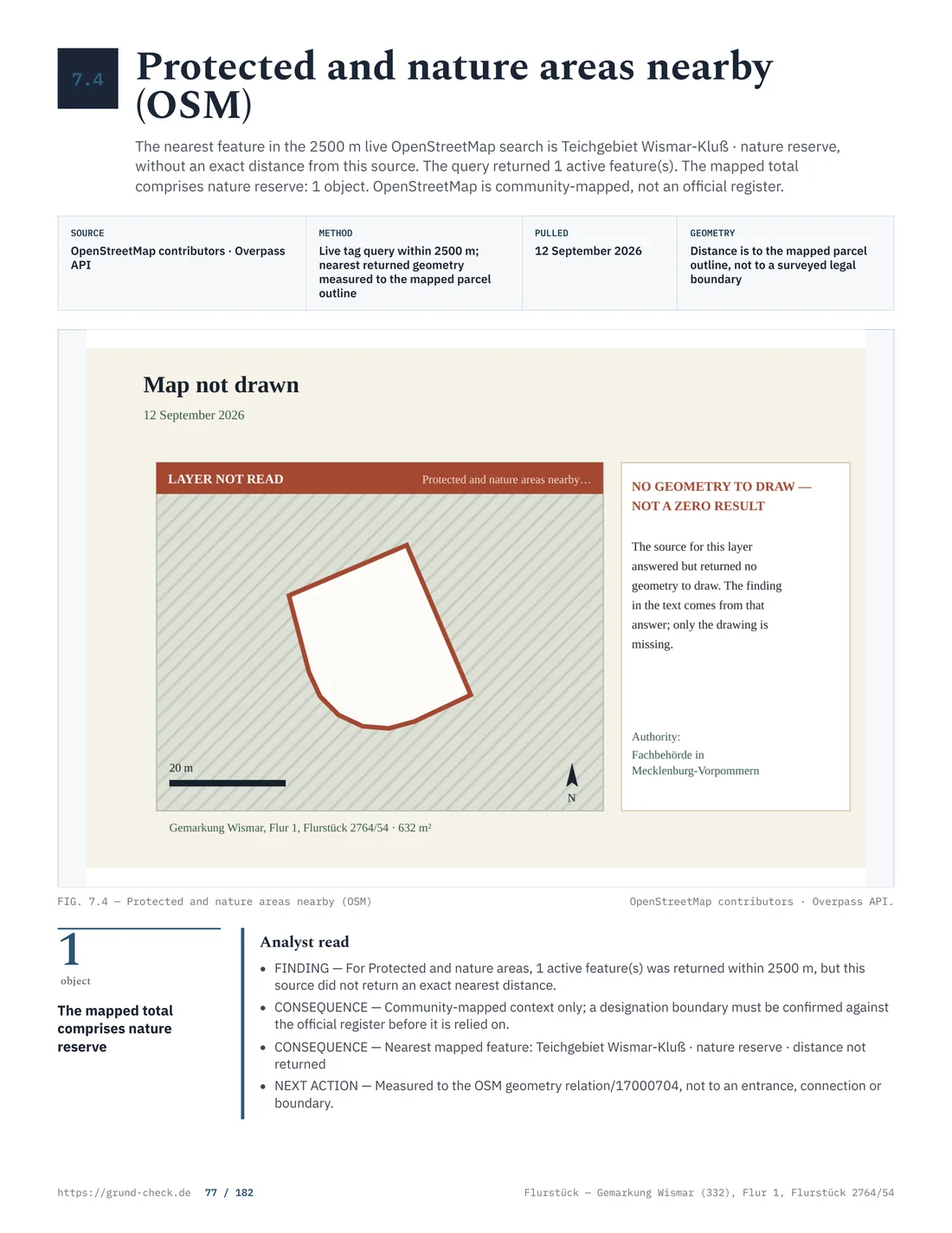
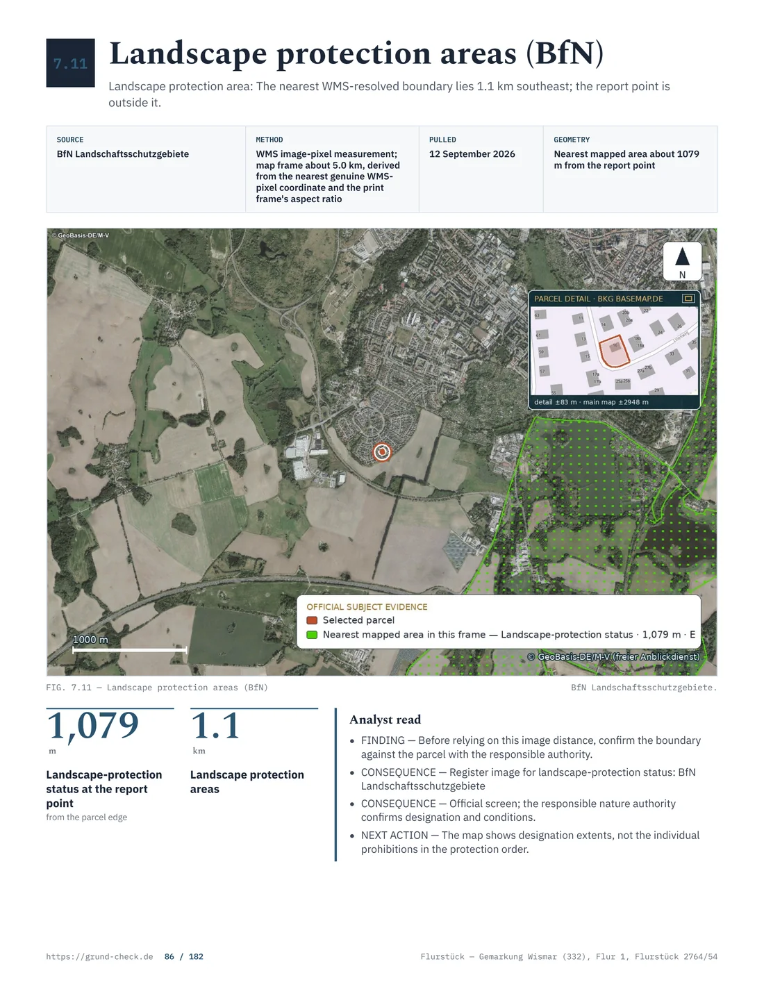
Nature designations in Germany run in a hierarchy. A Naturschutzgebiet is strictly protected and building is generally out of the question. A Nationalpark or Biosphärenreservat carries zoning of its own with strict cores. A Landschaftsschutzgebiet is much larger in extent and much weaker, but its ordinance usually makes new building subject to permission and the answer depends on the individual ordinance rather than on the label.
The state has a great deal of Landschaftsschutzgebiet, and it is the designation buyers meet most often. The task is to find the ordinance for that specific area, read what it makes subject to consent, and ask the lower nature authority at the Landkreis how it applies it. Two similarly named areas can be run quite differently.
Natura 2000 and the assessment it triggers
FFH areas and bird protection areas form the European network, and § 34 BNatSchG requires any project that could significantly affect one, in relation to its conservation objectives, to be assessed before it is approved. A project that would significantly affect the area is inadmissible, subject to a narrow derogation.
The trap is the word could. The obligation is triggered by potential effects, not by certainty, and a project outside the boundary can trigger it through noise, lighting, drainage or traffic. On a parcel adjoining a Natura 2000 area, ask the nature authority early whether an assessment will be required, because the assessment itself takes months and needs an ecologist.
Biotopes that are protected by law alone
§ 30 BNatSchG protects certain biotope types directly, without any designation on a map: among them natural and near-natural standing waters, reeds, wet meadows, moors, springs, dry grassland and dry heath. Actions that could destroy them or significantly impair them are prohibited.
This is the finding that surprises buyers. A wet corner of a meadow, a small pond, a patch of dry sandy grassland on a German plot may be protected in its own right, and no map at the district office is needed for the prohibition to apply. The state maintains a biotope inventory, but the protection does not depend on the parcel being in it. Where the ground looks like any of those types, a botanist's afternoon is cheaper than a stop-work order.
Species protection, and the season
§ 44 BNatSchG prohibits killing or disturbing specially protected species and damaging or destroying their breeding and resting places. This applies to a private building site exactly as it applies to a road scheme, and the species that turn up on German plots are ordinary ones: bats in an old roof, swallows and house martins on a barn, sand lizards on a dry slope, breeding birds in a hedge.
§ 39 BNatSchG adds the season. Cutting down trees, hedges and scrub is prohibited from 1 March to 30 September, so clearance work belongs in the winter. Municipal tree protection by-laws frequently require permission on top, whatever the season, and a replacement planting can be imposed as a condition.
The intervention rule, and what compensation costs
§ 14 BNatSchG defines an intervention in nature and landscape, and § 15 BNatSchG sets the order: avoid what can be avoided, compensate what remains through restoration or replacement measures, and where that is not possible, pay a substitution levy.
For an ordinary house on a plot inside a development plan this is usually settled at the plan level and does not reappear. For a project in the open countryside, for a large sealed area or for the removal of established vegetation, it can mean a separate compensation obligation with a real price attached, either as planting elsewhere or as a payment. Ask about it at the same time as the permit question, since the two are decided together. § 67 BNatSchG governs the exemptions that are occasionally available.
Water on the plot itself
Outside built-up areas, water law provides a five-metre Gewässerrandstreifen along watercourses, measured from the shoreline. Restrictions apply inside that strip, including a ban on removing natural bank vegetation. The rule comes from § 38 WHG. State variations in the comparison include § 29 WG BW; Art. 21 BayWG and Art. 16 BayNatSchG, including Art. 16 Abs. 1 Satz 1 Nr. 3; § 21 BremWG; § 26a HWaG; § 26 LWG SH; § 23 HWG; § 24 SächsWG; § 50 WG LSA and § 50 Abs. 1 WG LSA; § 56 Abs. 3 SWG; § 58 NWG, § 58 Abs. 1 NWG and § 58 Abs.1 NWG; § 90a LWG NRW and § 90a Abs. 1 LWG NRW; § 33 LWG Rheinland-Pfalz; § 29 Abs. 1 ThürWG; and § 77a BbgWG. The federal five-metre rule is stated in § 38 Abs. 3 WHG. A strip may look like an unused edge of the parcel on an aerial image, but it can affect the position of a fence, access route or building and the way the bank is managed. The exact watercourse and the line from which the five metres are measured need checking before a site plan is drawn.
Drainage ditches crossing a parcel often belong to a Wasser- und Bodenverband. Such an association may have a right to enter the land for maintenance and may keep a working strip along the ditch. The owner pays the relevant contribution. A ditch cannot simply be filled in or put into a pipe at the owner's choice: doing so can obstruct drainage and breach water law. The conveyance should therefore identify the ditch, the responsible association, the access arrangements and any contribution shown in the documents. A narrow blue line on a plan can represent a continuing operational obligation.
Rainwater may be dealt with by infiltration on the parcel or by discharge to a receiving water, but both routes require water-law permission under the applicable state's water law, the BbgWG. Sandy ground in some regions often favours infiltration, although a high groundwater table can remove that option. High groundwater is separate from flood risk: it affects whether a basement is sensible, whether a watertight concrete tank is needed and how much the foundations cost. The level is established by a soil investigation, not by a flood map. Before assuming the sandy soil will solve the problem, ask for the groundwater level at the planned foundation depth and for the seasonal range. A dry site visit proves little. The result can require drainage measures, a raised slab or a revised basement design, each with a cost that belongs in the purchase calculation. A watertight concrete basement instead of an ordinary cellar adds a five-figure sum, which against a building plot at Brandenburg's 2025 state average of 219 € per square metre can amount to a tenth of what the land itself cost.
The state can step in front of a sale
§ 66 BNatSchG gives the Länder a right of pre-emption on land that includes watercourses, shores, moors, marshes and other wetlands, and on land within protected areas. The applicable state has implemented it in the state nature conservation act.
For a buyer of a lakeside or moorland parcel, that is a real transaction risk rather than a theoretical one. The notary submits the contract, the authority has a statutory period to exercise, and if it does, the land goes to the state on the agreed terms and the buyer does not get it. Ask the notary to check the position before the appointment, and treat any waterside plot as a candidate. The pre-emption guide covers the other rights of this kind.
What each finding means
| Finding | Legal effect | Practical outcome | ||||||
|---|---|---|---|---|---|---|---|---|
| Designated flood area, § 78 WHG | building prohibited, narrow exception | usually fatal, occasionally solvable | ||||||
| Risk area, § 78b WHG | requirements, no prohibition | raised levels, no basement, insurance question | ||||||
| Naturschutzgebiet | strict protection | no new building | ||||||
| Landschaftsschutzgebiet | consent under the area ordinance | depends on the individual ordinance | ||||||
| Natura 2000 nearby | assessment under § 34 BNatSchG | months and an ecologist | ||||||
| § 30 biotope on the plot | prohibition, no map needed | the area is lost to building | ||||||
| Hesse | Additional state checkpoint: consult the current state guide and obtain the plot-specific written answer from the competent authority. | |||||||
| Mecklenburg-Western Pomerania | Additional state checkpoint: consult the current state guide and obtain the plot-specific written answer from the competent authority. | |||||||
| Lower Saxony | Additional state checkpoint: consult the current state guide and obtain the plot-specific written answer from the competent authority. | |||||||
| North Rhine-Westphalia | Additional state checkpoint: consult the current state guide and obtain the plot-specific written answer from the competent authority. | |||||||
| Rhineland-Palatinate | Additional state checkpoint: consult the current state guide and obtain the plot-specific written answer from the competent authority. | |||||||
| Saarland | Additional state checkpoint: consult the current state guide and obtain the plot-specific written answer from the competent authority. | |||||||
| Saxony | Additional state checkpoint: consult the current state guide and obtain the plot-specific written answer from the competent authority. | |||||||
| Saxony-Anhalt | Additional state checkpoint: consult the current state guide and obtain the plot-specific written answer from the competent authority. | |||||||
| Schleswig-Holstein | Additional state checkpoint: consult the current state guide and obtain the plot-specific written answer from the competent authority. | |||||||
| Thuringia | Additional state checkpoint: consult the current state guide and obtain the plot-specific written answer from the competent authority. | |||||||
Source: BNatSchG § 39(5), first sentence, no. 2; checked August 2026
Three mistakes that cost real money
Assuming a development plan settles every question. A plan that permits a house does not make water or nature law disappear. Those layers operate independently of the planning decision and can take away the result that the plan appears to promise. A buyer who stops at the zoning map may pay for a buildable plot, then discover a flood prohibition, a protected biotope or a watercourse setback that changes the usable area. The planning permission in principle is only one part of the answer.
Checking only the parcel and ignoring its surroundings. A Natura 2000 area beside the boundary can trigger an assessment even when no protected land lies inside the parcel. The possible effect can travel through noise, artificial light, drainage or traffic. The relevant question is not simply whether the red line crosses the property, but whether the proposed project could affect the area's conservation objectives. An early query to the nature authority and a look beyond the cadastral boundary can expose that work before a purchase contract fixes the timetable.
Putting tree and scrub clearance into a spring or summer schedule. From 1 March to 30 September, cutting down trees, hedges and scrub is prohibited under the seasonal nature-protection rule. Municipal tree-protection by-laws may require separate permission as well. If clearance is planned only after the building permit, the restriction can move the start of construction by several months and may require an ecological check for breeding birds or other protected species. The winter clearance window belongs in the programme before the offer is made. A schedule that leaves this question until the contractor arrives can lose the winter window entirely. The owner may then need to wait for autumn or redesign the access and building sequence. The delay is not a minor landscaping issue; it can affect finance, contractor availability and the date on which the land can be used.
A screening sequence that takes one evening
- Locate the parcel precisely, then open the Geoportal and switch on the water and nature layers.
- Check the designated flood area, the risk area and the distance to the nearest watercourse.
- Check protected areas, and note which category and which ordinance.
- Look at the aerial photograph for water, reed, wet ground and old trees, then walk the plot.
- Ask the lower nature authority at the Landkreis in writing what is recorded for the parcel.
- Ask an insurer for an indicative answer on flood cover for the address.
Find the constraints while they are still free to find. Order a GrundCheck preflight report and take a precise parcel picture into the water and nature screening. Check a parcel.
Where these rules are written
- Water: § 76, § 77, § 78 and § 78b WHG; state water law in the BbgWG.
- Nature: § 14, § 15, § 30, § 34, § 39, § 44, § 65, § 66 and § 67 BNatSchG; state implementation in the BbgNatSchAG.
- Maps and data: state geoportal, state cadastral viewer, Landesamt für Umwelt, GEOBROKER.
Rules and figures were checked in August 2026. This is general information for buyers, not legal or ecological advice on your parcel. Read next: contaminated land, building in the outer area and buildability.
What differs between states
State law and state mapping services determine additional watercourse margins, protected-area procedures and the competent authorities.