
State
Buying land in Saxony: registers, water and mining
In Saxony, SächsBO, the Baulastenverzeichnis, SALKA, watercourse buffers and municipal planning can decide whether a parcel is actually usable.
On this page
What makes buying land in Saxony different
Buying a parcel in Saxony means dealing with state law that gives the nationwide due-diligence questions a local shape. The main sources are the Sächsische Bauordnung, the Saxon building code, the Sächsische Wassergesetz, monument and forest law, and registers and portals operated by the Free State. An assertion in an estate brochure should therefore be checked with the responsible Gemeinde, Bauaufsichtsbehörde, the building supervision authority, and the specialist agency.
The first Saxony-specific question is the Abstandsfläche, the required building setback. Then come Baulasten, public-law building obligations, SALKA, the cadastre, the Bauvorbescheid, a preliminary building decision, and local planning. For land in the Außenbereich, the outer planning area, add water, forest, nature protection and possibly mining. The property due-diligence checklist helps file the answers as a purchase record.
Organise the risks before the notary appointment. A parcel check connects registers, planning law and location factors for the actual Flurstück (official cadastral parcel).
- Setbacks under § 6 Abs. 5 SächsBO
- SALKA and contaminated soil
- Bauvorbescheid under § 75 SächsBO
- Land value, BORIS and statistics
- Monument protection and declaratory registers
Source: SächsBO; Geoportal Sachsenatlas; BORIS Sachsen; SALKA; checked August 2026
Setbacks under § 6 Abs. 5 SächsBO
In Saxony, the depth of the Abstandsfläche is generally 0.4 H, at least 3 m. The cited provision does not state a separate general commercial factor; it also does not confirm a uniform core-area factor or a flat value for a narrow-side privilege. That is a Saxon distinction from generic tables that place other states' values side by side.
The setback normally lies on the building plot. On a narrow parcel it can limit the position of a house, garage or extension. Height, the wall involved, building on the boundary, the Bebauungsplan (legally binding local development plan), and local building rules must be read together.
The Sächsische Bauordnung is the source for the concrete check. A site plan showing the proposed building position says more than a general promise that the parcel is buildable.
Baulastenverzeichnis in Saxony
Under § 83 SächsBO, a Baulast (public-law building obligation) is assumed by written declaration to the Bauaufsichtsbehörde and entered in the Baulastenverzeichnis, the register of public-law building obligations. Saxony therefore has its own public-law register. No substitute mechanism is needed because this register exists.
A Baulast can secure access, a setback, parking spaces or utility lines for another building project. The Grundbuch extract, the land-register extract, does not answer that question. Before notarisation, the parcel-specific information from the responsible building authority belongs in the file.
The Saxon information on Baulasten explains how to request it. The legal text is also available in the REVOSax legal portal. The distinction between the Grundbuch and a Baulast is covered in Baulasten and building restrictions.
SALKA and contaminated soil
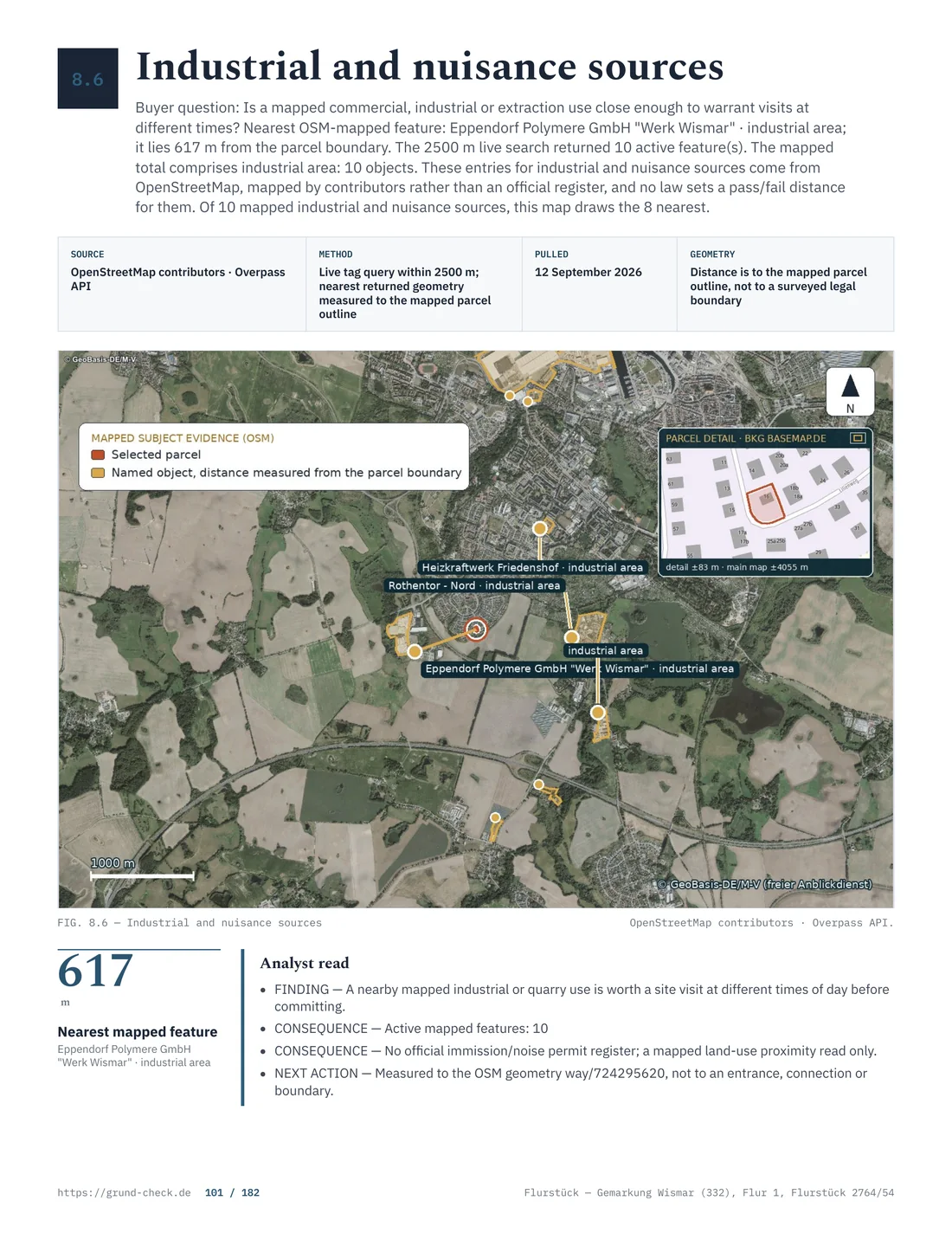
The Sächsische Altlastenkataster, usually called SALKA, records suspected contaminated sites and contaminated land. The responsible lower soil-protection authorities provide the information. A general public online view of every parcel-specific record is not confirmed.
A missing online result is therefore not a negative certificate. For the actual Flurstück, send Gemarkung and Flurstück number to the responsible authority. Former uses, expert reports and a soil survey can raise additional questions where the record suggests a problem.
The VwV SächsAltK is the Saxony-specific source for SALKA. Technical guidance is available from the Landesamt für Umwelt, Landwirtschaft und Geologie. The contaminated-site guide places the register check alongside surveys and the contract.
ALKIS and official surveying
ALKIS information and cadastral data in Saxony are supplied by the Staatsbetrieb Geobasisinformation und Vermessung Sachsen and the responsible surveying offices. The Saxon surveying authority describes the Liegenschaftskataster, the official cadastre. It does not establish a uniform fee status for every online product.
The ALKIS download area should therefore not be treated as a free proof of ownership. Before applying, decide whether you need a map extract, parcel information or an owner-related service. The cadastre, Grundbuch and Baulastenverzeichnis have different jobs. The land-register and ALKIS comparison helps keep them separate; boundaries and land surveying belongs in the file for boundary questions.
Bauvorbescheid under § 75 SächsBO
A Bauvorbescheid, or preliminary building decision, is valid for three years under § 75 SächsBO. An extension can be requested. For a purchase, the decisive point is the exact question answered by the decision: a preliminary decision is not a blanket promise for every later design.
The application should describe the plot, use, building volume, position and access precisely. A question about a single-family house can have different requirements from one about several flats or commercial use. The plans must relate to the land being bought.
Keep the official SächsBO text with the decision. The nationwide procedure is explained in building permits and pre-application.
Permit exemption and ancillary structures
§ 62 Abs. 3 SächsBO provides for Genehmigungsfreistellung, permit exemption, for projects within a Bebauungsplan. The cited provision does not attach the exemption to one general maximum building-class value. A period of 3 weeks is confirmed as the Saxon figure.
For projects that are verfahrensfrei, exempt from the procedure, § 61 Abs. 1 Nr. 1 and Nr. 7 SächsBO refer to Anlage 1. A value of 75 m³ is confirmed for a garden house; the checked schedule contains no flat slot value for garages. Inside built-up areas, a fence up to 2 m can be verfahrensfrei. No general statewide height value is confirmed for the Außenbereich.
Verfahrensfrei does not automatically mean materially lawful. The Bebauungsplan, setbacks, access, neighbour law and protection rules remain relevant. Read the Saxon building code with the municipality's answer.
Land value, BORIS and statistics
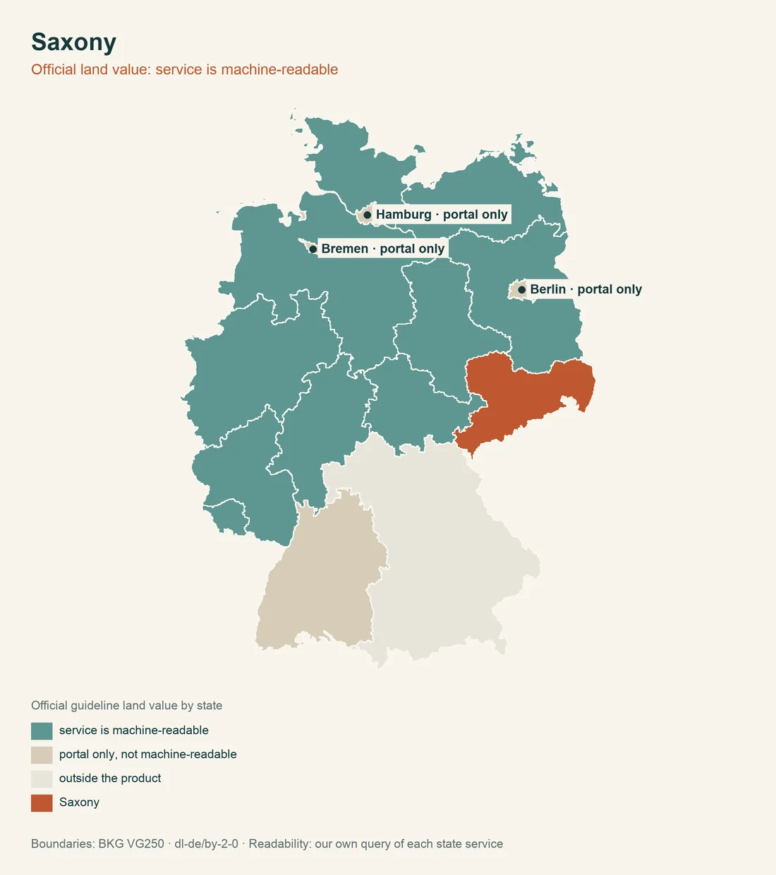
Official statistics give a confirmed 2024 average purchase value of 102,96 Euro per m² for baureifes Land, serviced building land, in Saxony. This average is not a Bodenrichtwert, a standard land value for a zone, and not an appraisal of the actual Flurstück. It describes statistical context, not a seller's promise.
A Bodenrichtwert belongs to a zone and a standardised plot. Use, access, shape, contamination and planning law can change the price. BORIS Sachsen supplies the zone value; the purchase-value statistics of the Saxon statistical office answer a different question.
For the terminology, see land value and Bodenrichtwert. Keep the two figures separate in the negotiation.
Watercourse buffers under § 24 SächsWG
§ 24 SächsWG together with § 38 WHG sets a Gewässerrandstreifen, a watercourse buffer, of 10 m in the Außenbereich and 5 m inside built-up areas in Saxony. A watercourse at the edge of the plot can therefore affect the buildable area, access and garden design. Check the Saxon width on site with the water map and authority.
The rule in the Sächsische Wassergesetz is the state-law source. The federal addition is § 38 WHG. A site plan with the buffer drawn on it shows whether the intended building actually fits.
Monument protection and declaratory registers
Under §§ 2, 10 SächsDSchG, the entry of built and archaeological monuments is declaratory. The Denkmalliste, the monument list, is therefore an important starting point, but not the sole answer to every monument-law question. A Schatzregal, state ownership of qualifying archaeological finds, is confirmed; a separate effective date is not confirmed in the checked source.
The Landesamt für Denkmalpflege Sachsen and Landesamt für Archäologie Sachsen are the specialist authorities. The SächsDSchG text and the Saxon monument list belong in the initial check. Earthworks may also require an archaeological assessment of the exact site. See monuments and archaeology. A verbal assurance in a sales conversation is not an authority statement.
Forest, nature protection and mining
Under §§ 8, 9 SächsWaldG, changing forest to another use generally requires approval. The law permits time-related reforestation conditions but does not state one uniform number of years. Do not value a forest parcel like unbuilt building land.
§ 38 Abs. 1 SächsNatSchG does not confirm a nature-protection pre-emption right of the state for this situation. Protected areas, biotopes and municipal rules can still limit use. The Geoportal Sachsenatlas is an official entry point for geodata.
For former mining, the Sächsische Oberbergamt is the contact under § 69 BBergG. Request mining information before deciding the price where the land has a history of mineral extraction. Further context is in buying forest land.
- Planning lawMunicipality or building authority
- Parcel and mapGeoportal Sachsenatlas
- Soil, value and hazardsSpecialist portal and competent authority
Source: SächsBO; Geoportal Sachsenatlas; BORIS Sachsen; SALKA; checked August 2026
Agriculture, neighbour law and hunting
Under § 1 Abs. 1 SächsAGGrdstVG, a purchase of agricultural land may require approval; the confirmed exemption threshold is 0.5 ha. The type and area of the land must therefore be clarified with the responsible office before notarisation.
§ 8 Abs. 1 SächsNRG gives a general boundary distance of 2 m for large trees and 0.5 m for small trees. No general duty to fence every plot is confirmed. Include the Saxon neighbour-law rule where planting or boundary structures already exist.
An Eigenjagdbezirk, a private hunting district, begins at 75 ha under § 10 SächsJagdG. This is rarely a separate issue for a normal building plot, but it can matter for large agricultural or forest holdings. Neighbour boundaries and private rights gives the wider context.
Taxes, fees and roads
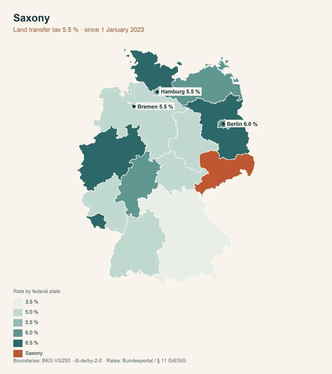
Real-estate transfer tax in Saxony is 5,5 percent under § 1 SächsGrEStSatzG. Property tax follows the federal model; a separate Saxon state model is not confirmed. The Saxon property-tax office helps explain the framework but cannot replace an individual assessment.
Building-law fees follow the Sächsisches Kostenverzeichnis. The Free State fee source lists the positions; the specific official act and circumstances determine the amount. A broker's flat statement is not an authority fee.
§§ 26 ff. SächsKAG confirm an optional municipal road-improvement contribution. No single statewide effective date for the current collection status is confirmed. Ask the municipality expressly about open contributions and the state of road works.
Ordnance and official responsibilities
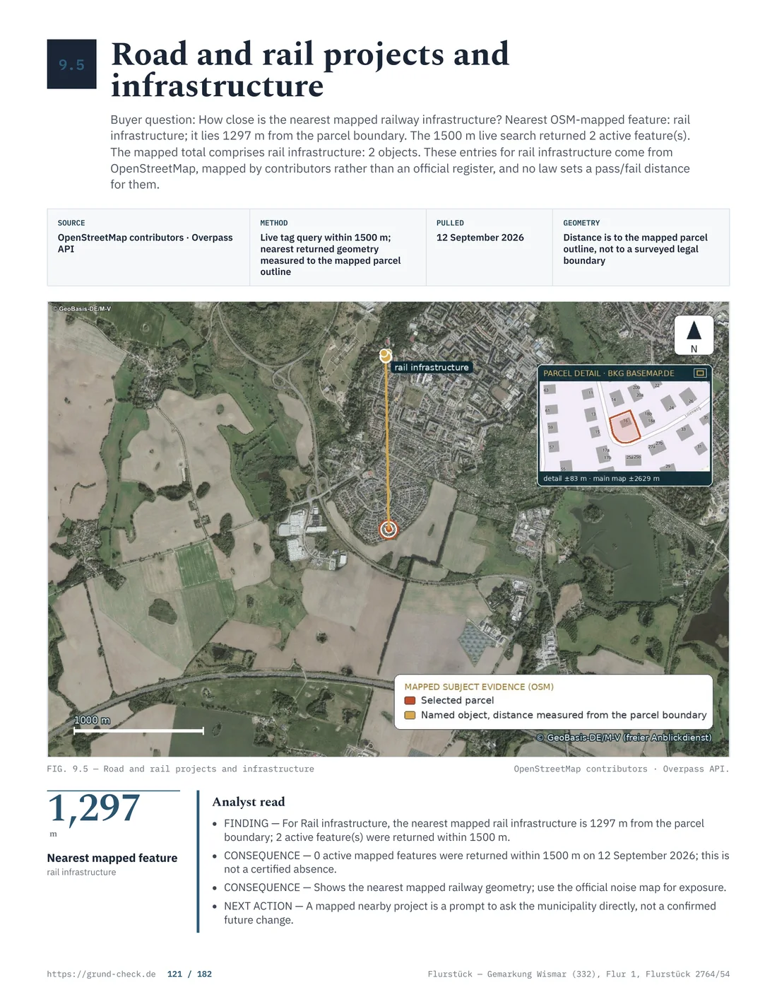
The Kampfmittelbeseitigungsdienst Sachsen, the Saxon bomb-disposal service, is the named body for unexploded-ordnance matters under the Sächsische Kampfmittelverordnung. The Free State information on the service confirms the body but not one uniform fee status for every enquiry. Costs can differ by reason and measure.
For planning law, use the Saxon development-plan portal and the municipality. For state law, the REVOSax legal portal is authoritative. Municipal rules remain relevant alongside state law.
| Check point | Saxon basis | Office or source |
|---|---|---|
| Setback | § 6 Abs. 5 SächsBO | building supervision |
| Baulasten | § 83 SächsBO | Baulastenverzeichnis |
| Contamination | VwVSächsAltK | lower soil-protection authority |
| Water | § 24 SächsWG | water authority |
Order of checks before buying
For the actual Flurstück, use a traceable sequence. First compare the parcel, boundaries, ownership data and Bebauungsplan. Then check Baulasten, SALKA, watercourse buffers, monument protection, forest and mining information. If the intended use remains unclear, a Bauvoranfrage, an application for a preliminary decision, can sharpen the Saxon question before purchase. The decision is valid for three years, but only answers the points asked.
Put the unresolved point in writing. With a parcel check, the source, Flurstück and authority answer stay together.
Do not skip municipal planning
The Saxon planning portal provides a statewide entry point, but the individual plan comes from the municipality's procedure. Rules on use, intensity, building lines, green areas or traffic areas can matter more than a general statement about the location. File the plan drawing, explanatory statement and planning-office answer together.
If access is unclear, ask the municipality about outstanding road or connection issues. The access and infrastructure guide cannot replace that local answer. A positive BORIS Sachsen result answers only the value question; it says nothing about Baulasten, contamination, water or monuments. The comparison guides state geoportal comparison and state transfer-tax comparison provide context, while the Saxon authorities remain decisive for the Flurstück.
In a city or municipality, also ask whether a local building rule or by-law adds requirements. State law sets the frame, while municipal planning decides many details. For financing, keep confirmed figures separate from unconfirmed assumptions, especially the cost of an ALKIS request, each ordnance enquiry and any case-specific reforestation period.
Sources and further reading
Information checked on 6. August 2026. This is general information and does not replace an answer from the responsible building authority, municipality or specialist agency. Responsible editor: GrundCheck editorial team. Read next: access and infrastructure, pre-emption rights and approvals, and buying forest land.