
State
Buying land in Thuringia: permits, data and boundaries
In Thuringia, ThürBO, THALIS, state neighbour law and special water buffers shape the purchase check. Tax and land-value statistics also need local context.
On this page
Thuringia's purchase checks at a glance
Buying land in Thuringia means dealing with federal law, the Thüringer Bauordnung, the ThürBO, and several state specialist offices. The state rules on setbacks, Baulasten, preliminary decisions, water and monuments are especially practical for a buyer.
A map or estate brochure does not answer these issues finally. The municipality, building supervision authority, Thüringer Landesamt für Bodenmanagement und Geoinformation and other specialist offices each hold only part of the information. Start the property due-diligence checklist with the Flurstück (official cadastral parcel).
Sort the Thuringian documents before notarisation. A parcel check connects state-law points with the general purchase file.
- Setbacks under § 6 Abs. 5 ThürBO
- THALIS instead of a blanket contamination assumption
- Planning viewer and permit-free projects
- Thuringian watercourse buffers
- Neighbour law for trees and fences
Source: ThürBO; Geoportal Thüringen; BORIS-TH; THALIS; checked August 2026
Setbacks under § 6 Abs. 5 ThürBO
§ 6 Abs. 5 ThürBO generally sets the depth of the Abstandsfläche, the required building setback, at 0.4 H, at least 3 m. In commercial and industrial areas and comparable special areas, 0.2 H, at least 3 m, is sufficient where the statutory condition is met.
The confirmed ThürBO provision does not state a separate general core-area factor. Nor does it confirm one uniform narrow-side privilege. The building position must therefore be read against the actual project, Bebauungsplan (legally binding local development plan), and local building rules. The ThürBO setback rule should be read before a parcel division. A plan showing the proposed external wall is more useful than a promise that a house will fit. The state setback comparison shows only the differences between state rules.
Baulasten in Thuringia
§ 82 ThürBO provides for the Baulastenverzeichnis, the register of public-law building obligations. A Baulast (public-law building obligation) is assumed by written declaration to the building supervision authority and entered in the register. The building supervision authority keeps it; parcel-specific information can be requested through the Thüringer Verwaltungsportal.
This is a public-law obligation, not a side agreement in the purchase contract. A private Grunddienstbarkeit, a civil-law easement, does not fully replace a public-law Baulast. The official material does not identify a state-wide substitute mechanism.
Keep the Thuringian citizen service for the Baulastenverzeichnis and the administrative portal for Baulast information in the file. The distinction is explained in Baulasten and building restrictions.
THALIS instead of a blanket contamination assumption
The Thüringer Altlasteninformationssystem is called THALIS. The official contaminated-site guidance describes it as a digital system for suspected contaminated land and contaminated sites and as an information base for authorities.
A complete, unrestricted public online view of all parcel-specific records is not confirmed. A buyer of land with former industry, dumping or unknown fill should therefore request information from the responsible authority under environmental-information law. The request needs a precise parcel reference.
The Thuringian THALIS contaminated-site guidance is the specialist source. The contaminated-site guide explains how to add a soil survey and contractual protection.
ALKIS and free parcel data
The Thuringian citizen service points to the Liegenschaftskataster information system for cadastral extracts. The TLBG supplies ALKIS data without owner information, particularly NAS and Shape data, through its official online shop. The confirmed product information describes these named datasets as free.
Owner information is not included. A free parcel record is also not proof that the land is buildable. Boundaries, buildings, ownership, Baulasten and planning law require separate checks. The Thuringian cadastral-extract service and the TLBG ALKIS online shop describe access. The land-register and ALKIS comparison explains their evidential roles.
Planning viewer and permit-free projects
The Thüringen planning viewer is a research access point for municipal building and land-use planning data. The municipality's by-law and publication remain legally binding. Before purchase, establish which version applies to the Flurstück.
Under § 64 Abs. 1 and Abs. 3 ThürBO, Genehmigungsfreistellung, permit exemption, is available in particular for building classes 1 to 3 within a Bebauungsplan. Conditions include compliance with the plan, secured access and the municipality's declaration. Work may generally begin one month after the required documents have arrived. The statute deliberately gives no fixed number of weeks.
The Thuringia planning viewer and the ThürBO permit-exemption rule are different sources. The zoning and buildability guide covers the nationwide planning level.
Preliminary decision under § 82 ThürBO
A Bauvorbescheid, a preliminary building decision, is valid for three years under § 82 ThürBO. The provisions on the duration and extension of a building permit apply correspondingly. For a buyer, the date is not enough; the exact scope of the decision matters.
A good Bauvoranfrage describes use, building volume, position and access. A decision on residential use does not automatically answer questions about a garage, division or access. Put the open question in its own purchase-check item. The Thuringian preliminary-decision rule is the state source. The general procedure is in building permits and pre-application.
Thuringian watercourse buffers
§ 29 Abs. 1 ThürWG sets its own Gewässerrandstreifen, or watercourse-buffer, widths. In the Außenbereich, the outer planning area, the basic width is 10 m; within built-up areas it is 5 m. Thuringia therefore departs from the federal basic width in § 38 Abs. 3 WHG.
The width alone does not answer what is allowed on the strip. Exceptions, prohibitions, the bank position and the planning classification must be checked together. A planned access road or fill can be treated differently from an existing building. Keep the ThürWG water-buffer rule beside the federal WHG rule. The flood and nature-risk guide adds the practical context.
Monument list and archaeological finds
Under the ThürDSchG, monument protection is declaratory. That applies to built and archaeological monuments: entry in the Denkmalbuch, the monument book, does not create protection for the first time. A parcel may therefore need checking even when the brochure says nothing about a monument.
The Thüringisches Landesamt für Denkmalpflege und Archäologie, abbreviated TLDA, carries out the statewide specialist tasks. § 24 ThürDSchG and the monument list are useful starting points. § 17 ThürDSchG creates a state Schatzregal under statutory conditions; a separate effective date for that rule is not confirmed.
The TLDA monument list and the ThürDSchG rules on entry and the Schatzregal belong in the initial check. Monuments and archaeology adds the practical steps.
Neighbour law for trees and fences
The Thüringer Nachbarrechtsgesetz, or ThürNRG, regulates trees and fences separately. Under § 44 ThürNRG, very fast-growing trees generally need a boundary distance of 4 m. The source gives 2 m for fast-growing trees and 1.5 m for other trees. Fruit trees and special situations can have their own categories.
§ 39 ThürNRG provides a conditional duty to fence. Within a built-up area, a neighbour may demand a fence if it is needed to prevent substantial interference. This does not create a general duty for every parcel. Apply the ThürNRG boundary-distance rule to existing growth and fences. The boundaries and land-survey guide keeps this issue separate from building law.
Forest, mining and ordnance
Changing the use of forest generally requires approval under §§ 10, 23 ThürWaldG. §§ 10, 23 ThürWaldG set a reforestation period of 6 years where the provision applies. A forest parcel should therefore be checked with the lower forest authority before purchase.
The Thüringer Landesamt für Umwelt, Bergbau und Naturschutz, TLUBN, is the specialist office for mining enquiries. Official pages also list former mining as an information subject, but the confirmed material does not give one uniform value for the cost of a former-mining enquiry. The Informations- und Dokumentationsstelle Kampfmittelräumung in the Free State of Thuringia is the named route for ordnance information. No uniform cost status for every enquiry or measure is confirmed.
The TLUBN mining-information service and the Thuringian ordnance information must not be treated as substitutes for one another.
- Planning lawMunicipality or building authority
- Parcel and mapGeoportal Thüringen
- Soil, value and hazardsSpecialist portal and competent authority
Source: ThürBO; Geoportal Thüringen; BORIS-TH; THALIS; checked August 2026
Tax, agriculture and land value
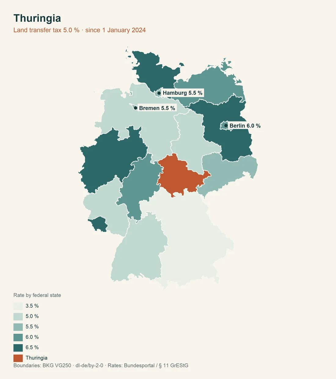
Under § 1 GrEStSatzG TH, Thuringia's real-estate transfer tax rate is 5 percent; the confirmed version applies from 2024. The state generally uses the federal property-tax model, with its own state-law adjustment for certain cases from the 2027 assessment period. The municipal multiplier remains decisive.
For agricultural and forestry land, § 1 of the Thuringian statute on approval-free transfers of agricultural and forestry land gives an exemption threshold of 0.25 ha. Land type, contract, use and further conditions still require an individual check.
The Thuringian transfer-tax rule, the Finance Ministry property-tax information and the agricultural-transfer exemption answer different questions.
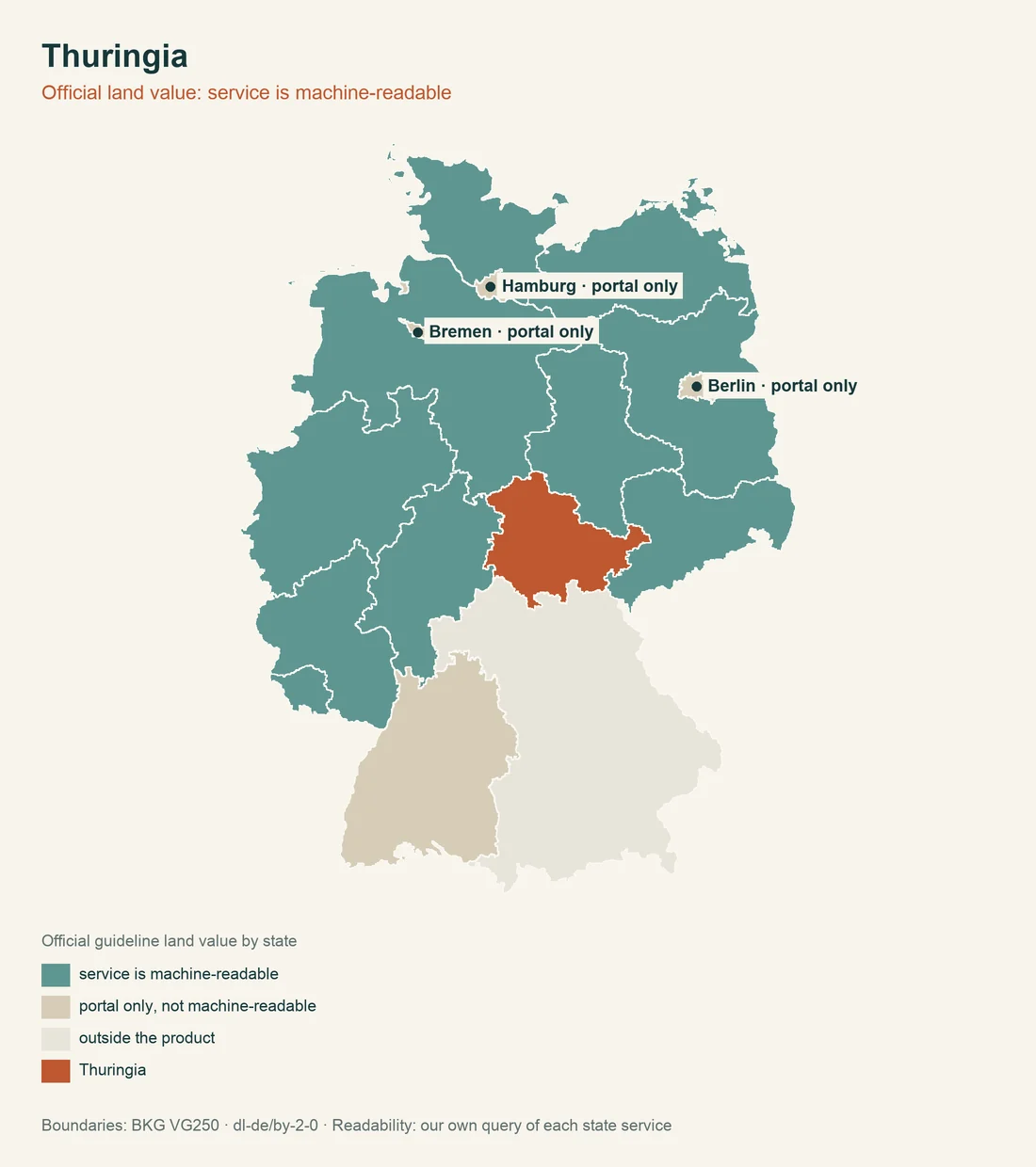
The Thuringian statistical office gives baureifes Land an average purchase value of 74.09 EUR per m² in 2025. The figure comes from the table for Thuringia as a whole and baureifes Land; it is not a promise for one Flurstück. Check Bodenrichtwert, access, use and shape separately. The Thuringian land-price statistics should be compared with BORIS Thüringen. The comparisons state building-obligation comparison and state road-contribution comparison give context, not an appraisal.
| Thuringian check | Confirmed state rule | Purchase consequence |
|---|---|---|
| Setback | § 6 Abs. 5 ThürBO: 0.4 H, at least 3 m; commercial and industrial areas 0.2 H, at least 3 m | calculate building position |
| Baulast | § 82 ThürBO: Baulastenverzeichnis | request building-authority information |
| Water | § 29 ThürWG: 10 m in the Außenbereich, 5 m inside built-up areas | check use beside water |
| Transfer tax | 5 percent under § 1 GrEStSatzG TH | calculate purchase costs |
| Land value | 74.09 EUR per m² for baureifes Land in 2025 | do not treat statistics as an appraisal |
Permit-free ancillary structures
§ 63 Abs. 1 Nr. 1 Buchst. a and b and Nr. 7 Buchst. a ThürBO describes verfahrensfreie projects. Garages are covered up to 50 m² floor area and up to 3 m average wall height where the location and use conditions are met. Single-storey buildings without rooms for residence can be procedure-free outside the Außenbereich up to 10 m² floor area.
Walls, including retaining walls, and fences are verfahrensfrei inside built-up areas up to 2 m. For the Außenbereich, § 63 ThürBO confirms no uniform height value. Procedure-free also does not mean materially lawful; the plan, access and neighbour law remain relevant. The ThürBO rule on ancillary structures is more useful for a garden house, garage or fence than a generic brochure statement.
Purchase-file checklist
Start with Flurstück, planning viewer and secured access. Then check Baulastenverzeichnis, ALKIS, THALIS, water, monument list, forest and mining information and the boundary. This order prevents a free map service from being mistaken for a complete building-law answer.
For every result, record office, date, Flurstück and exact question. An empty map result is not a general negative decision. Where a point is not confirmed, ask the authority in writing.
Prepare the contract only with documented open points. Notary process and closing and parcel check come after the authority file.
Do not mix information from several Flurstücke. A Baulast, water buffer and contamination notice can affect different subareas. A positive preliminary decision does not automatically answer monument or neighbour-law questions. A written answer should be attached to the contract, so later there is no confusion about parcels or responsibility.
Sources and further reading
Checked on 07.08.2026. The named Thuringian authorities, legal portal and statistical office were used. This is general information and does not replace the responsible authority's answer. Read next: Baulasten, monuments and archaeology, and access and infrastructure.