
Property report · Germany
Check the plot
before you buy.
Pick your parcel on the map. About ten minutes later you have a PDF report: official cadastral data, surroundings and access, flood and protected-area indicators, and the questions to put to the Bauamt and your notary.
EUR 29 final price · ready in about ten minutes · pay once, no subscription
Start with the parcel
Your parcel on the map.
Search an address or tap the map. Review the highlighted parcel before ordering.
One parcel as the reference point
Every statement stays tied to your parcel.
The report reads planning, water, ground, surroundings and protected interests against the exact parcel you confirm.

What the report covers
The checks before the next step.
Each point names its source, data date and the specialist check that may still be needed.
Parcel and location
Official identifier, geometry and municipality.
01Planning and permitted use
The development plan is read at parcel level in Brandenburg, Berlin, Hamburg, Mecklenburg-Western Pomerania and North Rhine-Westphalia. Elsewhere the report marks the gap and names the responsible Bauamt.
02Flooding and contaminated land
Official flood scenarios in every state, heavy rain where a map exists. The report reads no contaminated-land register; it names the authority to ask and the question to put.
03Services and access
Roads, utilities and points for further review.
04Nature and heritage
Protected areas from the Federal Agency for Nature Conservation in every state. The heritage register is read in Brandenburg; elsewhere the report names the heritage authority and the question to ask.
05Documents still to obtain
A priority list for authorities, planners, surveyors and, where relevant, a notary.
06Guide topics
Concrete questions instead of broad promises.
50 articles in German and English. Plain terms and next questions.
The order to check a German parcel in, which office answers what, what each document costs, and the answers that should stop a purchase.
The land register guarantees rights, the cadastre supplies the geometry. What each one proves, how to obtain both, and what a mismatch costs.
Why the line on the map is not the line on the ground, who may establish a boundary, what a survey costs, and what to do about a difference in area.
Maps from the sample report
Nine real maps from one Flensburg report.
All nine map extracts come from the same Flensburg dossier and show the same parcel in its surroundings.
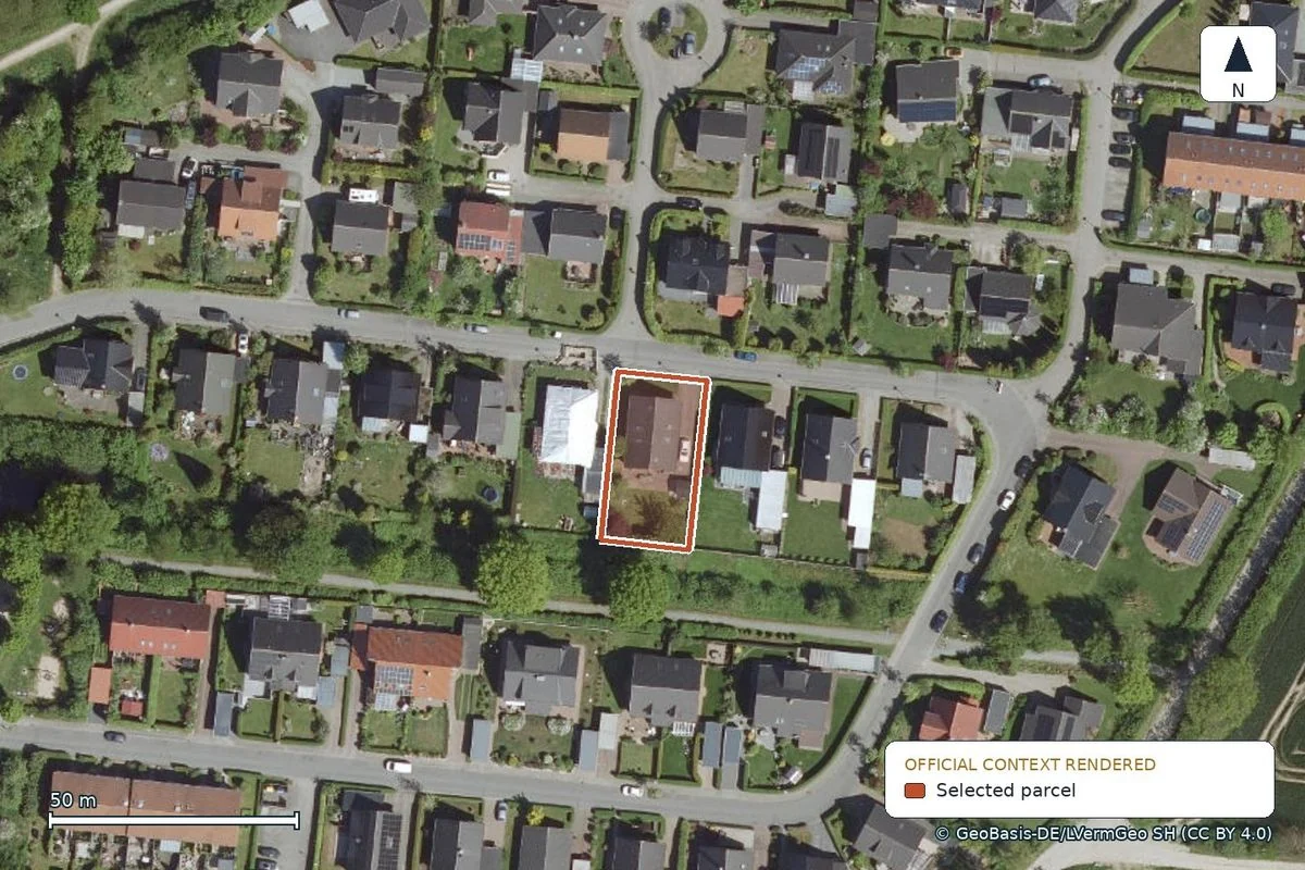
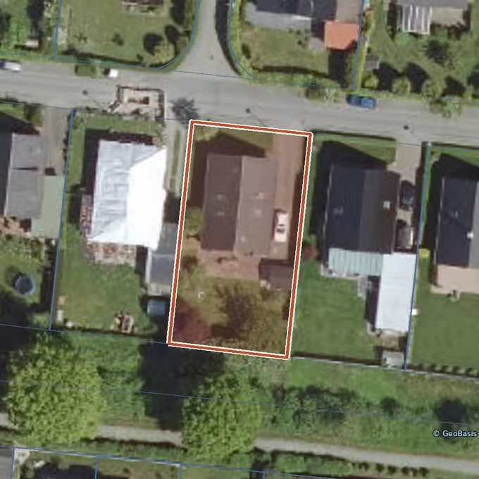
Where the parcel boundary runs
The official outline places the parcel among its neighbours.
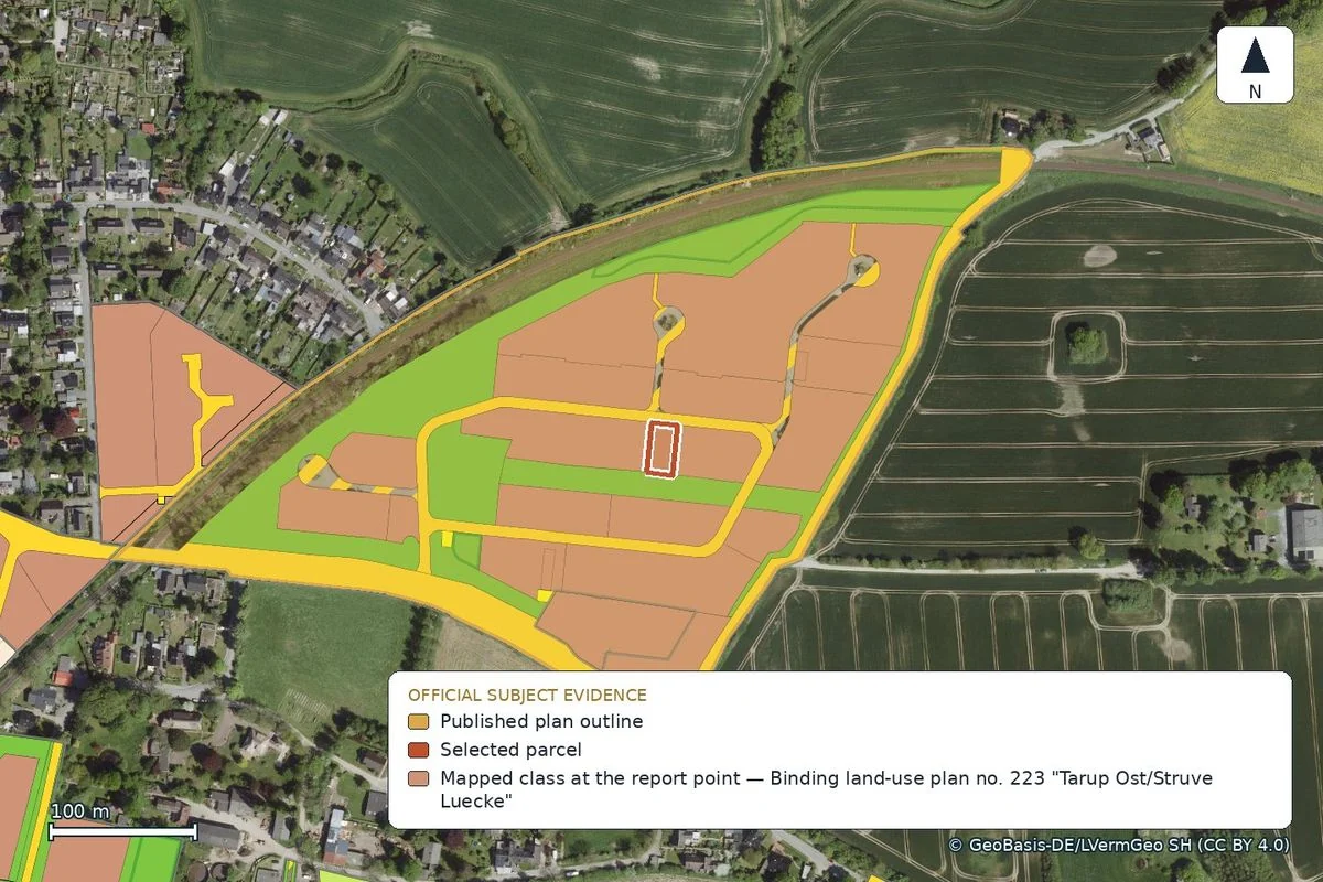
Which development plan covers the parcel
The parcel lies within development plan No. 223 “Tarup Ost/Struve Luecke”.
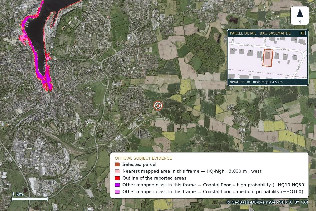
Where flood areas are mapped
The official map shows the nearest flood areas along the Flensburg Fjord, about 3 km west. The parcel lies outside them.
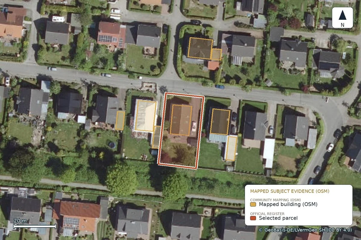
How densely the surroundings are built
The map shows every building recorded in OpenStreetMap around the parcel.
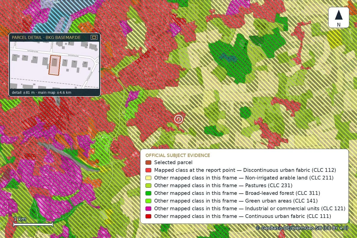
How the surrounding land is used
The European land-cover survey assigns every area around the parcel to a class.
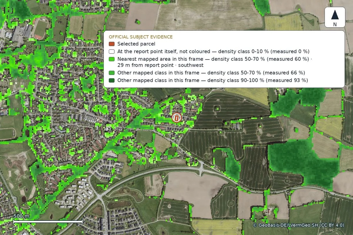
How dense the tree canopy is
The satellite survey gives canopy density at the parcel and around it.
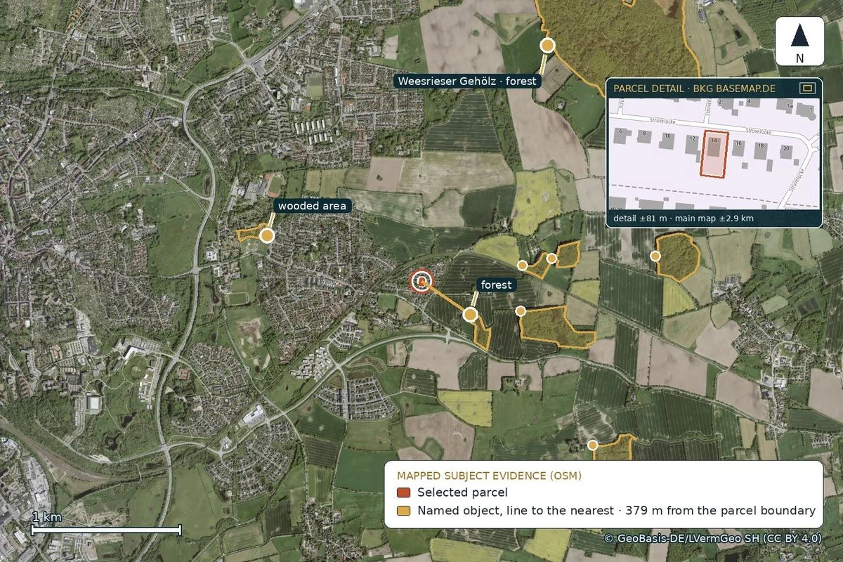
Where woodland is mapped nearby
The map shows forest and wooded areas recorded in OpenStreetMap.
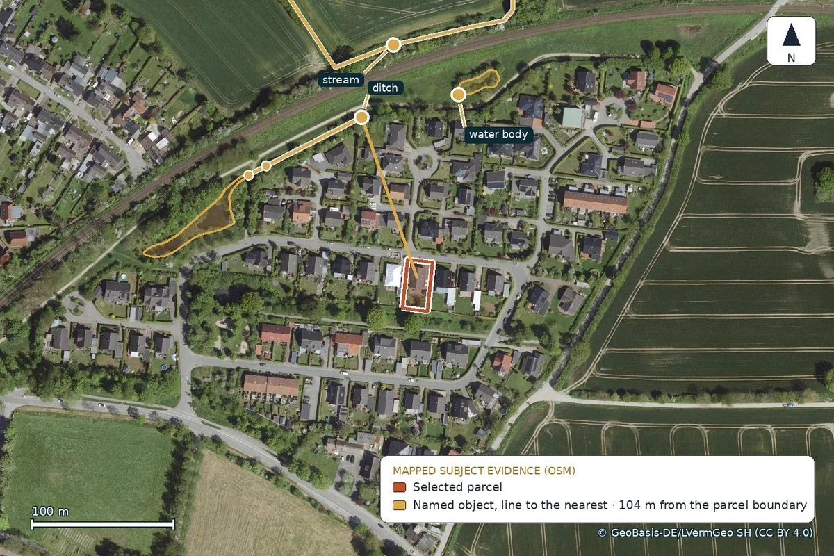
Which watercourses run nearby
The map names the streams and water bodies and measures the distance to the parcel.
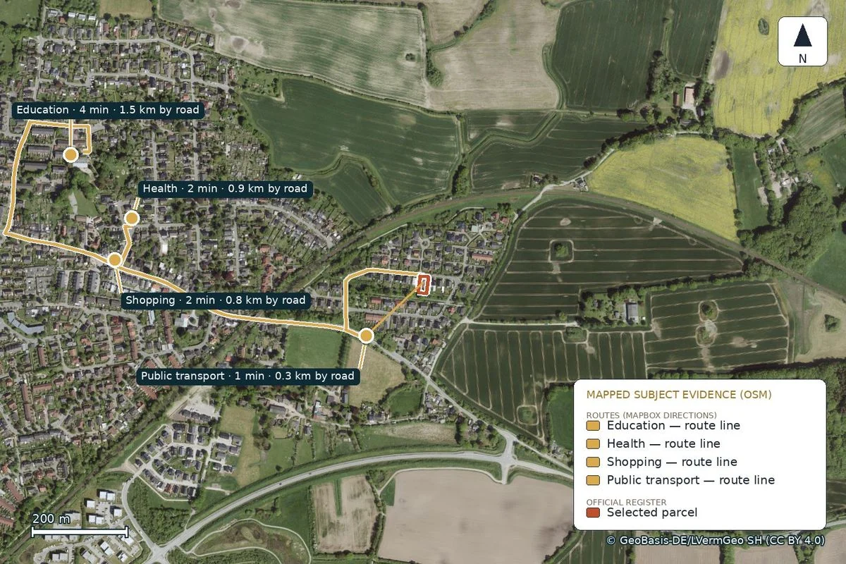
How long everyday drives take
Drive times follow the road network and exclude live traffic.
How it works
From the map to a parcel-specific report.
Find the property
Search an address or click the Germany map.
Choose the parcel
Load official data and inspect the highlighted parcel.
Confirm it
You confirm that the highlighted ground is correct.
Order the report
Generation starts after payment. The report is ready in about ten minutes.
Real report pages
This is what the delivered report looks like.
Six unaltered pages from the current Flensburg report: parcel, planning, water, terrain, land value and routes.


More than a map
Know the documented status of the parcel.
The report separates documented findings, limited inferences and open original records. It is useful to owners, planners and people considering a purchase.
Pricing
One complete report. You choose the language.
EUR 29 for one complete German or English edition. EUR 39 for both editions. EUR 29, EUR 39 and EUR 10 are final consumer prices. No tax, fee or other charge is added.
On coverage: the development plan is currently queried at parcel level in Brandenburg, Berlin, Hamburg, Mecklenburg-Western Pomerania and North Rhine-Westphalia. In the other states the report marks that gap and names the municipality and the Bauamt. The report reads no contaminated-land register in any state; instead of a result it names the lower soil-protection authority and the question to put to it. Pick a parcel and the map lists all twelve topics for your state, what the report reads and what stays open, always before you pay.
Each report takes about 10 minutes.
One edition
One complete edition, German or English. You can add the other edition later from the delivery page.
German or English
- ✓ Complete property report
- ✓ Ready in about ten minutes
- ✓ PDF download
Both editions
One complete German PDF and one complete English PDF in the same order.
German and English
- ✓ Two complete PDFs
- ✓ About ten minutes per edition
- ✓ Add the second language later for EUR 10 from the delivery page, reached through the private link in the delivery email
Questions about scope and limits
What the service does and where it stops.
Which region is covered?
A point-based report is available in all 16 federal states. Official parcel outlines are available in 15 federal states. Deep state-specific thematic sources are connected for Brandenburg, Mecklenburg-Western Pomerania and North Rhine-Westphalia; parcel-level planning data is verified for Brandenburg, Berlin, Hamburg, Mecklenburg-Western Pomerania and North Rhine-Westphalia. Bavaria does not publish parcel outlines openly, so the order page shows which checks remain open there before purchase.
In which federal states is the development plan actually read?
At parcel level in Brandenburg, Berlin, Hamburg, Mecklenburg-Western Pomerania and North Rhine-Westphalia. There we query the official planning service for the selected plot and report what it returns. In Hesse we read the plan where the municipality has published it as a queryable dataset in Geoportal Hessen. In Schleswig-Holstein we read the plan where the municipality has published it in the Land's development-plan service, as in the Flensburg sample. In the remaining states the report reads no development plan automatically: it marks the gap and names the municipality and the Bauamt as the authoritative sources for the answer. Bavaria does not publish parcel outlines as an open data service, so the report stays point-based there. An empty result never proves that no development plan applies.
What does a report cost?
One German or English edition costs EUR 29. Both editions cost EUR 39. You can add the second language later for EUR 10 from the report's delivery page, reached through the private link in the delivery email.
What is in the report?
The report puts parcel, location, public planning data, visible risk indicators and open questions for further review in one place.
Is the report legally binding?
No. It does not replace a land register extract, a building pre-application, legal advice or a survey.
Found a property? Check its documented status now.
One language EUR 29, both EUR 39. One report is ready in about ten minutes.