
State
Buying land in Saarland: mining damage and ground movement
In Saarland, mining history belongs in every land review. Alongside LBO and the Bebauungsplan, check ground movement, mining damage, contamination and building control.
On this page
Why land in Saarland raises a mining question
Saarland is small, but its plots lie in very different settings: former mine sites, settlements above extraction areas, commercial land and rural locations do not require the same review. When buying, the question of ground movement can therefore matter more than an attractive site plan. A plot without a visible depression is not automatically free of mining risk.
The starting point is the specific parcel. The GeoPortal Saarland for development and land-use plans helps classify the planning surroundings. Section 10 BauGB concerns the Bebauungsplan (legally binding local development plan); the Saarland building code, LBO, governs setbacks, procedures and individual building projects alongside it.
The documents must match the parcel. The property due-diligence checklist organises the requests, while checking the property starts the review of the specific plot.
- Clarify mining damage before the notary appointment
- Setbacks under § 7 Abs. 5 LBO
- Preliminary decision and permit exemption in Saarland
- Neighbour law: trees and fencing in Saarland
- Heritage protection and finds
Source: LBO Saarland; Geoportal Saarland; BORIS Saarland; LUA-Altlastenauskunft und Bergbehörde; checked August 2026
Clarify mining damage before the notary appointment
The Bergamt Saarbrücken is responsible for mining matters in Saarland. The statutory responsibility refers to § 63 Abs. 4 BBergG. For practical location screening, the state also maintains the Saarland ground-movement register.
The register is a warning signal, not an automatic finding of damage. Extraction area, possible impact zone, previous measurements and intended use are decisive. A house, retaining wall or new access can trigger different requirements for settlement and cracking risks than an undeveloped green area.
Mining information also does not replace a building survey. The buyer should ask the seller about earlier cracks, repairs, insurance claims and known stabilisation measures. The guide to soil surveys and foundation reports helps separate mining-law information, private damage evidence and geotechnical investigation.
The contaminated-site register and mining are separate checks
Saarland maintains the register for contaminated and suspected contaminated sites. Its basis is § 4 Saarländisches Bodenschutzgesetz together with § 21 BBodSchG and §§ 3 and 4 UIG. The register is not generally open to the public. A specific request must therefore go through the competent office and must not be confused with an open map search.
Former mining can create separate soil and building-ground questions through spoil heaps, fill, workshops or industrial uses. The contaminated-site register does not answer whether a building has subsided because of extraction. Conversely, an entry in the ground-movement register does not prove chemical contamination.
For a defensible purchase decision, parcel, use history and planned earthworks should be described together. The contaminated-site and soil-contamination check therefore belongs beside the mining request in the contract file.
Setbacks under § 7 Abs. 5 LBO
In Saarland, the regular setback depth under § 7 Abs. 5 LBO is 0.4 H, at least 3 m. The rule gives 0.2 H for commercial areas. A narrow-side privilege is not confirmed. There is no fixed factor for core and special areas: the building control authority may permit a depth below 0.4 H there.
This is particularly relevant for hillside land. Height must be determined from the actual terrain and planned building, not from a simplified sketch. A setback can reduce the buildable zone even where the plot appears large enough on paper.
The Saarland building code on setbacks should be read with the site plan and height information. The guide to boundaries and land surveying addresses the private boundary between neighbours.
A Baulast (public-law building obligation) exists, but the access route needs confirmation
Saarland maintains a Baulastenverzeichnis under § 83 LBO. The existence of the instrument is confirmed. The exact register name used in practice and a reliably confirmed address for requesting information could not be verified in machine-readable form in the checked source.
The buyer should state this gap openly. Ask the lower building control authority, with cadastral district and parcel, whether a Baulast is entered and how an extract should be requested. An oral statement from the seller's circle is not a substitute. The § 83 LBO provision in the state-law portal is the statutory reference.
A Baulast, easement and mining-damage security serve different functions. A public-law obligation can enable or restrict development; a right of way in the land register answers the access question. The documents must not disappear in the contract under one general heading of encumbrances.
Preliminary decision and permit exemption in Saarland
Under § 76 LBO, a preliminary decision is valid for three years. On application in text form, the period can be extended by up to one year at a time. Anyone buying for a particular residential or commercial use should describe the decisive question precisely: use, building position, height, access and servicing belong together.
The permit exemption under § 63 LBO is a separate procedure. Subject to its conditions, it extends to building class 5. Section 63 Abs. 4 Satz 2 LBO gives a period of one month, not a statutory number of weeks. The procedure does not remove the applicant's duty to check substantive lawfulness.
The service description for a preliminary decision and § 76 LBO on its validity are useful for the purchase file. For a project in a mining-damage area, the building question should also be connected with the geotechnical situation.
Do not assess a garden shed, garage and fence by a blanket rule
Section 61 Abs. 1 LBO makes certain projects procedure-free. A confirmed volume for garden sheds is 75 m³. A garage is not limited by volume there, but by a gross floor area of 36 m² and an average wall height of 3 m. Converting that rule into cubic metres would not be reliable.
For fences inside the built-up area, the rule gives 2 m. No general height value is confirmed for fences in the outer area; open fences and pasture fences for agricultural or forestry plots are mentioned. This can matter for a Saarland plot with a large garden or pasture.
The annex to § 61 LBO belongs in the existing-conditions review. Procedure-free does not mean free from setbacks, Bebauungsplan, neighbour law or heritage protection. Existing ancillary structures should be documented with photographs, measurements and their actual use.
Neighbour law: trees and fencing in Saarland
Saarland has its own Neighbour Rights Act, NachbG SL. Section 48 and § 43 Abs. 1 NachbG SL govern these questions. A boundary distance of 4 m is confirmed for large trees, and 1.5 m for small trees and shrubs. A fencing duty is also confirmed.
These distances must not be confused with the public-law setbacks under § 7 LBO. One rule concerns the position of structures, the other the private boundary between neighbours. On a plot with mature trees, both levels should be shown on the site plan.
The § 48 NachbG SL provision is the relevant source for planting distances. Before purchase, also check whether a fence really stands on the boundary or uses part of another plot.
Water, forest and nature-conservation areas
Saarland differs from the federal starting point for watercourse strips. Section 56 Saarländisches Wassergesetz gives 10 m for the outer area. A state-law inner-area width is not confirmed in the checked source. The strip must therefore not be derived from a blanket map or a general number for every location.
For forest plots, §§ 8 and 9 LWaldG apply; converting forest requires approval. No reforestation period in years is confirmed. In the outer area, the nature-conservation pre-emption right under § 66 BNatSchG may also apply.
The Saarland Geoportal provides the spatial starting point. For the legal consequence, the protection-area boundary, parcel and intended use should be compared in writing with the competent office. A forest map answers neither the mining-damage nor the contaminated-site question.
Heritage protection and finds
The Saarland heritage protection law is called SDSchG. The Saarland heritage-protection service portal refers to the Landesdenkmalamt Saarland. Entry of architectural and archaeological monuments is declaratory. The purchase review should therefore not end with a visible list.
Sections 3 and 4 SDSchG address heritage questions, while § 18 SDSchG concerns archaeological monuments and the treasure trove rules in SDSchG. The treasure trove rule has been confirmed in Saarland since 1 August 2018. Earthworks on older sites can therefore create notification and coordination duties.
The Saarland architectural-monument data is a starting point, not an approval. Heritage protection, mining, contaminated sites and building ground belong in separate chapters of the purchase file.
Building-land price, Bodenrichtwert and taxes
Official statistics give an average purchase value for serviced building land in Saarland in 2025 of 135.02 euros per m². The figure comes from the purchase-value statistics for building land and, because of regional and annual variation, is not a price promise for the individual parcel.
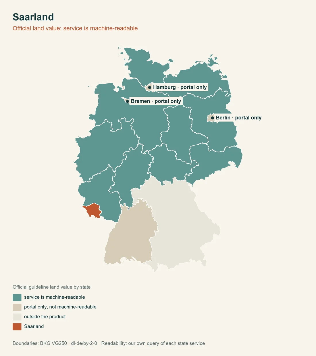
The Saarland Bodenrichtwert portal provides free access to official land values. Bodenrichtwert, purchase-value statistics and the asking price should stand beside one another in negotiations. Mining damage, hillside location, missing access or contaminated sites can make the economic assessment differ substantially from a reference value.
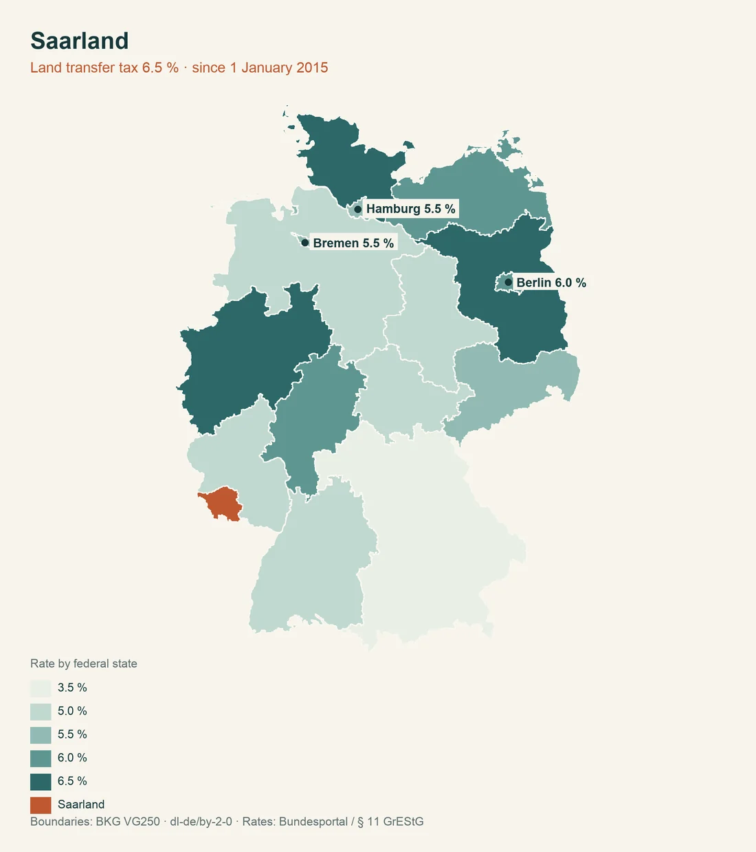
Real estate transfer tax is 6.5 percent under the Saarland rate-setting law. Saarland uses the federal model for property tax and also has its own property-tax statute. The Saarland real estate transfer tax information belongs in the calculation of ancillary purchase costs.
- Planning lawMunicipality or building authority
- Parcel and mapGeoportal Saarland
- Soil, value and hazardsSpecialist portal and competent authority
Source: LBO Saarland; Geoportal Saarland; BORIS Saarland; LUA-Altlastenauskunft und Bergbehörde; checked August 2026
Unexploded ordnance and servicing in rural areas
The Saarland ordnance-clearance service is responsible for unexploded ordnance. The request is not subject to a fee. Here too, the answer should target the specific parcel and planned earth movement. Mining information does not show whether unexploded ordnance is suspected.
For outer-area plots, secured servicing matters alongside the Bebauungsplan. A private road may work through a land easement, Baulast or another security, but these instruments are not interchangeable. On hillside land, access, water drainage and stability must be considered together.
The guide to access and infrastructure should be read with the ground-movement register and Baulast question. Saarland is shaped not merely by distance from the nearest city but by the technical accessibility of the specific plot.
Public contributions and land transactions
Saarland levies road-improvement contributions. The confirmed legal bases are §§ 8 and 8a KAG Saarland and § 83 Kommunalselbstverwaltungsgesetz. For a plot with planned servicing or road works, the rule can change the calculation. A seller's statement about earlier payments does not automatically answer whether future measures are pending.
Land- and forestry plots also require attention to the land-transaction review. No confirmed hectare threshold appears in the checked source. No threshold should therefore be placed in the contract or purchase decision until the competent office has classified the specific land.
The amendment to municipal contribution law and Saarland land-transaction law are different sources. One concerns contributions; the other concerns approval of agricultural land transactions.
Order of checks for Saarland
The sensible sequence starts with the parcel, Bebauungsplan and servicing. Next come the ground-movement register, Bergamt, contaminated-site register and ordnance-clearance service. Only then is it possible to assess whether a soil report, technical stabilisation or contract condition is needed.
| Question | Saarland-specific point | Evidence |
|---|---|---|
| Mining | Bergamt Saarbrücken and ground-movement register | Parcel-specific information |
| Contaminated sites | Register not generally public | Request under § 4 Saarländisches Bodenschutzgesetz |
| Setback | 0.4 H, at least 3 m; commercial 0.2 H | Site and height plan under § 7 LBO |
| Preliminary decision | Three years, extension of up to one year | Decision under § 76 LBO |
| Water | 10 m in the outer area under § 56 Saarländisches Wassergesetz | Watercourse and parcel comparison |
| Price | 135.02 euros per m² for serviced building land in 2025 | Statistic separate from Bodenrichtwert |
Every document should carry its date, authority and parcel. A positive preliminary application does not remove a mining-damage question; a ground-movement indication does not decide whether the building form is permitted. These levels should remain visibly separate in the file.
Open points can be written into the purchase contract as conditions or document-delivery duties. These may include mining information, proof of a Baulast, the contaminated-site request, a positive preliminary decision or clarification of servicing. A general statement in the sales brochure is weaker than an attached authority document.
For properties with older buildings, cracks, tilting, repair invoices and former uses should be documented. A surveyor should know whether the site lies above an extraction area. This prevents a purely structural finding from missing the cause of movement.
The official legal and portal pages were available as references on 7 August 2026. State law, the municipality, local planning and map data can change. For a concrete purchase, contact the lower building control authority with the cadastral district and parcel.
Put the risk questions before signing. The comparisons of heritage protection across Germany and building without a permit across Germany supplement the state-specific review; the comparison of German geoportals helps classify official map data. Check the property.
The planning file also records the references to § 10 BauGB and § 61 Abs. 1 LBO.
Sources and limits of the information
Checked on 7 August 2026. Some Saarland legal portals do not technically deliver the full statutory text. Where a particular figure or information route could not be confirmed, this is stated expressly. Missing confirmation is not a negative answer about the plot.
- Saarland state-law portal.
- Regional statistics: purchase values for building land.
- Valuation committees and Bodenrichtwerte.
- Saarland building code.
Further reading: soil surveys and foundation reports, contaminated sites and notary process and closing.