
State
Buying land in Rhineland-Palatinate: soil and values
Rhineland-Palatinate has its own rules for setbacks, public-law building obligations, contaminated sites, water, forest and road-improvement contributions.
On this page
What differs when buying land in Rhineland-Palatinate
When land is bought in Rhineland-Palatinate, state-specific information is spread across building control, the municipality, the surveying administration, the Struktur- und Genehmigungsdirektionen and state offices. The Landesbauordnung Rheinland-Pfalz (LBauO), Rhineland-Palatinate building code, is decisive for setbacks, Baulasten, permit exemption and procedure-free structures. Water, heritage, soil and forest law add further layers.
The relevant question is not merely whether a sales brochure calls the plot building land. Before the notary appointment, the parcel, Bebauungsplan (legally binding local development plan), servicing, Baulasten, BIS-BoKat and possible protection areas should fit together. The property due-diligence checklist helps organise the file.
Sort the risks before deciding. A property check connects registers, planning law and location.
- Setbacks under § 8 LBauO
- Baulasten under § 86 LBauO
- BORIS.RLP and the building-land price
- Watercourse strips under § 33 LWG
- Heritage protection under § 20 DSchG
Source: LBauO Rheinland-Pfalz; GeoPortal.rlp; BORIS.RLP; BIS-BoKat; checked August 2026
Setbacks under § 8 LBauO
Under § 8 LBauO, the setback depth is generally 0.4 H, at least 3 m. The available official source does not establish a separate general commercial or core-area factor. The actual space therefore depends on wall height, the building and local planning.
Section 8 Abs. 9 LBauO contains special rules for boundary garages and subordinate buildings without their own setback. Position, wall height and boundary length must be checked individually. A narrow parcel is not automatically suitable for a small building.
The LBauO synopsis is the confirmed state source. A site plan belongs with the request to the local building control authority.
Permit exemption under § 67 LBauO
Section 67 Abs. 2 LBauO enables a permit-exempt procedure for projects within the scope of a Bebauungsplan when the statutory conditions are met. The rule is not tied to one maximum building class; it depends on location, plan and project characteristics.
The municipality checks whether the project can proceed under the exemption or requires an approval procedure. The confirmed deadline is one month; after that, work may generally begin if the municipality has not decided otherwise and the remaining conditions are met. An exemption does not remove the substantive requirements applying to the land.
The official application information and the municipality clarify the route for the specific project.
Baulasten under § 86 LBauO
Rhineland-Palatinate maintains a Baulastenverzeichnis under § 86 LBauO. A Baulast (public-law building obligation) may concern access, parking spaces, setbacks or utilities. Its administration and proof in the cadastral register are also governed by the administrative regulation.
A land-register extract is therefore not enough before purchase. The extract for the exact parcel should be compared with intended use, site plan and servicing. An obligation in favour of a neighbouring plot may limit buildability of the purchased land.
The Rhineland-Palatinate service portal for Baulast information describes access. The administrative regulation is in the official Baulasten source.
ALKIS and surveying data
Sections 14 to 16 LGVermG Rheinland-Pfalz provide the framework for the official cadastral register. LVermGeo, Geoshop and the surveying and cadastral offices provide ALKIS data and geodata services. Owner data is subject to special conditions.
The official state information explains that ALKIS data can be available online free of charge. The specific product still needs checking. A geodata service, cadastral map and owner-related information have different evidential value and must not be treated as proof of building law.
The LVermGeo geodata services and the product information for cadastral data are the relevant state sources. The comparison of road-improvement contributions across Germany helps separate cadastral and municipal issues.
BORIS.RLP and the building-land price
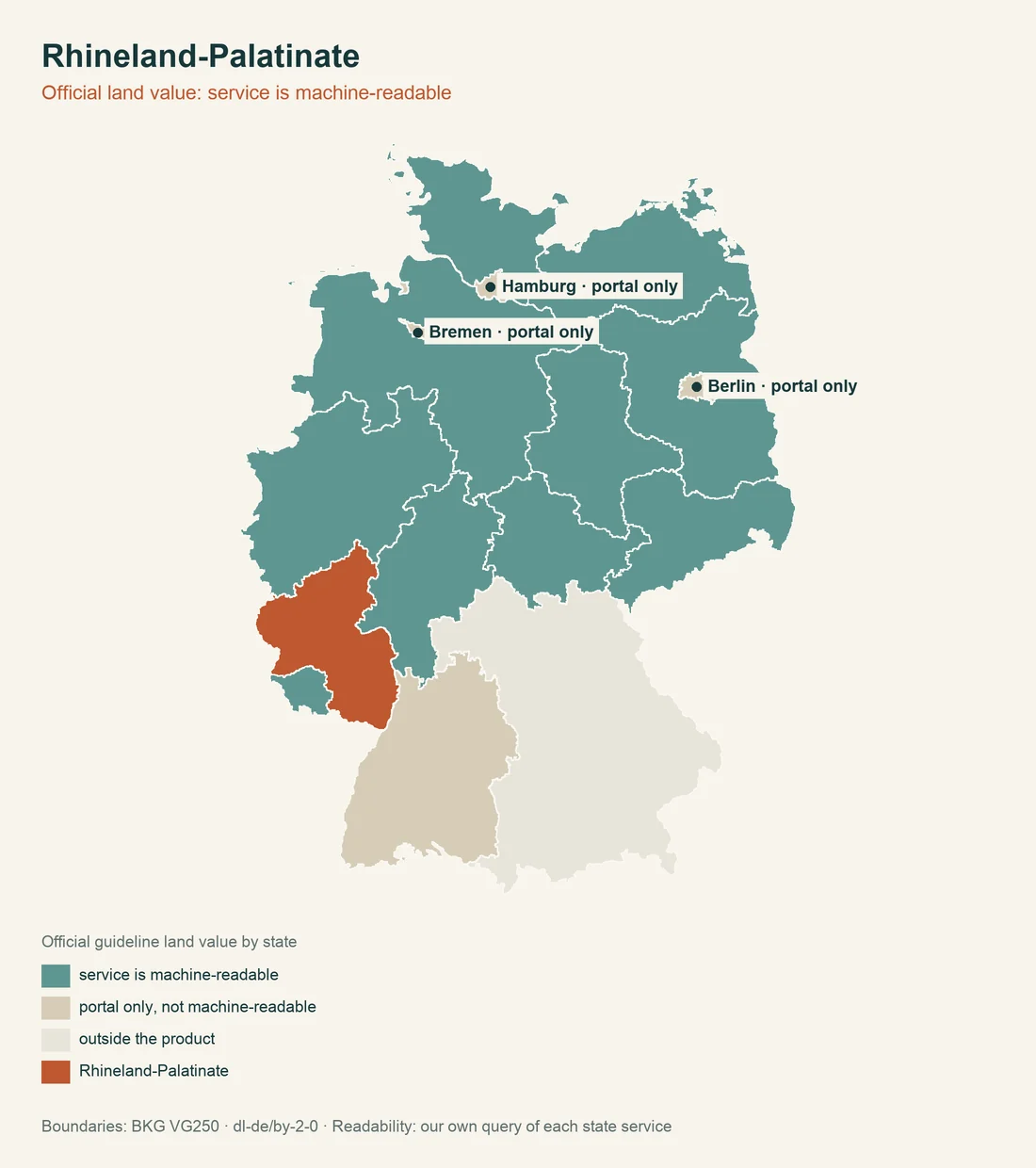
Section 196 BauGB and § 15 LGVerm RP sit alongside the Bodenrichtwert service. BORIS.RLP is free for private use in its basic service; additional data sets with further descriptive features may carry a fee. The Bodenrichtwert describes a zone, not automatically the purchase value of the specific land.
The Statistical Office of Rhineland-Palatinate reports an average purchase value for serviced building land in 2024 of 175 EUR per m². This is based on purchase values and is neither a Bodenrichtwert nor a price index. Servicing, a vineyard or hillside location, shape and planning law can change the individual case substantially.
The sources are BORIS.RLP and the purchase-value statistics. The nationwide concepts are explained by Bodenrichtwert and land value.
Bebauungsplan and GeoPortal.rlp
GeoPortal.rlp combines official geodata and map viewers. For land-use planning, § 10 BauGB applies together with state geodata law. The municipality is the planning authority; legal validity depends on the original publication or the municipality.
A map view is therefore useful first orientation, but not a substitute for the plan document. With a subdivision, an outer-area location or a possible change of use, the municipality should confirm the planning classification for the specific land.
The GeoPortal.rlp is the state-wide starting point. Official statutory texts are available through Rhineland-Palatinate state law.
BIS-BoKat and contaminated sites
Sections 9 to 10 LBodSchG Rheinland-Pfalz provide the framework for the soil protection register. The specialist system is called BIS-BoKat or Altlastenkataster Rheinland-Pfalz, the Rhineland-Palatinate contaminated-site register. It contains information on former industrial sites, old deposits and suspected contaminated areas; the competent Struktur- und Genehmigungsdirektionen provide parcel information.
General public access to every parcel-related record is not confirmed. The absence of a visible map entry is therefore not a negative certificate. Where there was former commercial use, fill material or unusual soil conditions, the request should state the cadastral district and parcel.
The state environment office information systems are the official starting point. Further steps are covered by contaminated sites and soil contamination.
Watercourse strips under § 33 LWG
Section 33 LWG Rheinland-Pfalz connects state law with § 38 WHG. A width of 5 m is confirmed for the outer area. There is no fixed state-wide width for the inner area; designations may be made by the higher water authority for a particular watercourse section.
Until a different state-law designation applies, the federal framework in § 38 Abs. 3 WHG remains the reference value. A blanket transfer to every watercourse would therefore be wrong. The parcel should be checked by watercourse section, location and administrative designation.
The municipality, water authority and site plan support this research. The watercourse strip belongs on the site plan.
Old mining and unexploded ordnance
Section 69 BBergG is the basis for old-mining questions. The Landesamt für Geologie und Bergbau Rheinland-Pfalz, the state office for geology and mining, maintains mining information; its old-mining traffic-light map supports a review of cadastral districts. A map does not replace information about the specific parcel.
The Kampfmittelräumdienst Rheinland-Pfalz at the Aufsichts- und Dienstleistungsdirektion is responsible for unexploded ordnance. The central service supports authorities in dealing with hazards from old ordnance. A uniform fee status for every request or measure is not confirmed.
The sources are the state office for geology and mining and the ADD ordnance service. The guide to soil surveys and foundation reports adds the geotechnical perspective.
Heritage protection under § 20 DSchG
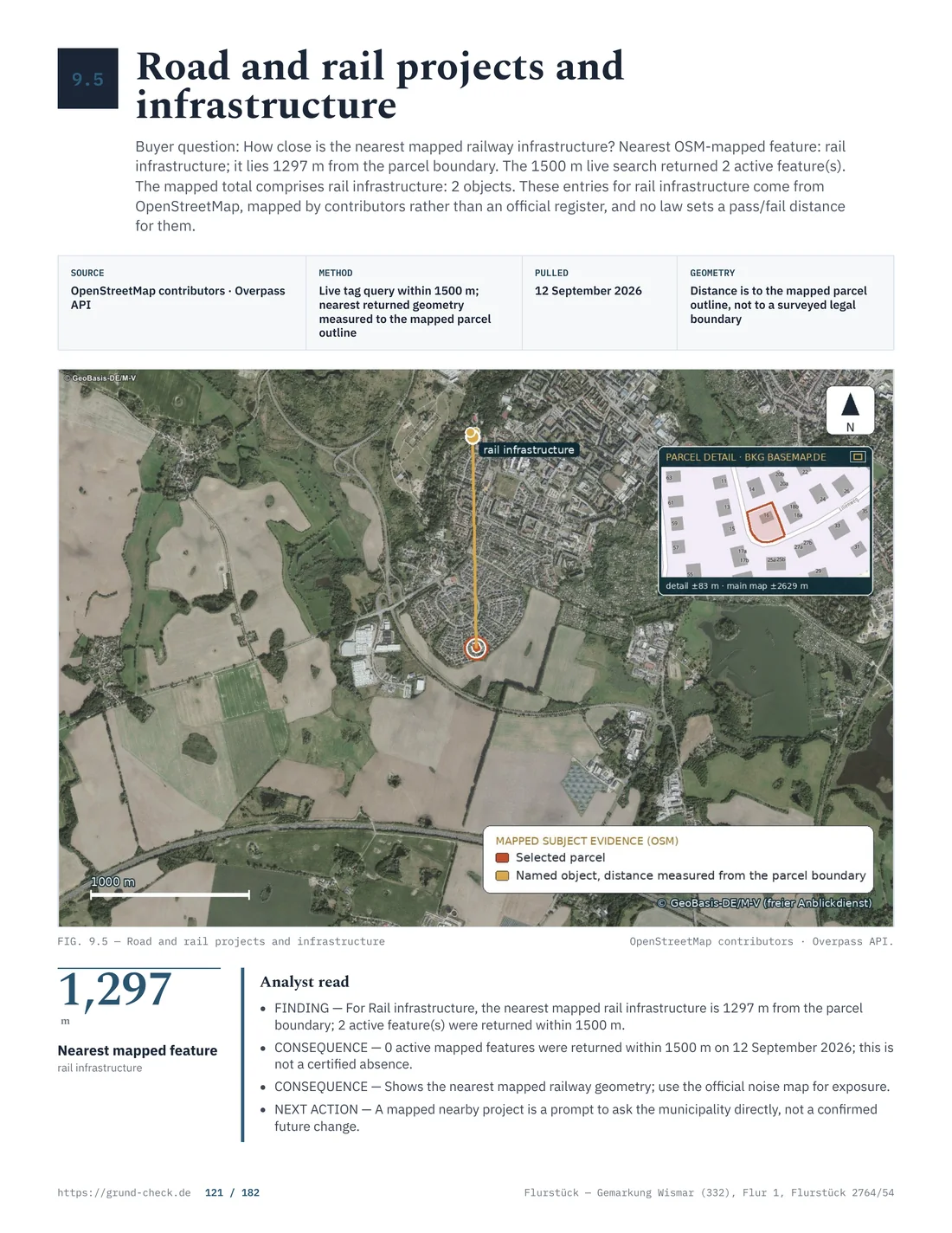
Under § 20 DSchG Rheinland-Pfalz, heritage status is declaratory. Buildings and archaeological monuments are protected even before they appear in a list. The treasure trove rule under § 22 DSchG exists; no confirmed start date is stated.
The Generaldirektion Kulturelles Erbe Rheinland-Pfalz and the lower heritage authorities are the specialist contacts. A heritage map supports research, but the authority gives the specific legal answer. Archaeological issues during earthworks can change the time and cost plan.
The official heritage protection law and the state heritage service belong in the file.
Forest and agricultural land
Under §§ 14 and 15 Landeswaldgesetz RP, converting forest requires approval. Forest may be cleared and changed to another land use only with permission from the forestry office. No uniform state-wide year deadline for reforestation is confirmed.
For agricultural land, the official land-transaction page describes several approval situations. No clearly general hectare threshold for exemption is confirmed. Buyers should clarify the land type and intended use directly with the competent office.
The forestry information on land-use change and the ADD land-transaction source are the starting points.
- Planning lawMunicipality or building authority
- Parcel and mapGeoPortal.rlp
- Soil, value and hazardsSpecialist portal and competent authority
Source: LBauO Rheinland-Pfalz; GeoPortal.rlp; BORIS.RLP; BIS-BoKat; checked August 2026
Neighbour law and contributions
Sections 44 to 47 NRG Rheinland-Pfalz regulate boundary distances for trees, shrubs and individual vines. Very fast-growing trees generally require 4 m, while the confirmed group of slow-growing fruit trees requires 1.5 m. Other species have their own rules. A general fencing duty for every plot is not confirmed.
Section 10a KAG Rheinland-Pfalz concerns recurring road-improvement contributions. They are charged under the statutory conditions and municipal billing areas; contributions under §§ 127 ff. BauGB remain a separate legal field. For a plot with planned servicing, ask the municipality about outstanding contributions.
The neighbour-law provision and the service portal on road-improvement contributions show the state-specific points of reference.
Taxes, fees and the preliminary decision
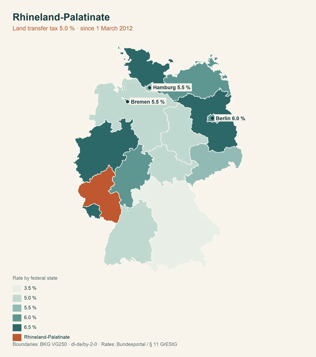
Real estate transfer tax in Rhineland-Palatinate is 5 percent. For property tax, the state generally uses the federal model under §§ 13 to 15 GrStG; the municipality sets the multiplier. Tax law and purchase price must be calculated separately.
Under § 72 LBauO, the Bauvorbescheid, preliminary building decision, binds for the statutory period; the state information names 4 years and a possible extension on application. The exact question must be clear in the decision. A general statement about buildability does not necessarily answer setbacks, servicing and nature conservation.
For building-control fees, the competent ministry publishes the special fee schedule. The Rhineland-Palatinate tax administration, property tax information and ministry building regulations belong in the review.
Procedure-free ancillary structures under § 62 LBauO
Section 62 LBauO lists procedure-free projects, but procedure-free does not mean automatically lawful. Buildings without habitable rooms may have a volume of 50 m³ under the confirmed conditions; in the outer area, the value for this category is 10 m³. Garages and covered parking spaces have a confirmed floor-area value of 50 m². Further wall and ridge heights and exceptions require individual checking.
Section 62 LBauO provides no general state-wide height value for fences. A Bebauungsplan, neighbour law and municipal by-law may still impose requirements. Existing garden sheds, garages and walls should therefore be placed on the site plan.
The documentation on § 62 LBauO is the confirmed source. For use and buildability, see zoning and buildability.
Checklist for a Rhineland-Palatinate parcel
Before notarisation, the evidence should be assigned to a parcel and a specific use:
| Question | State-law reference | Evidence |
|---|---|---|
| Does the building form fit? | § 8 and § 67 LBauO | Site plan and municipality |
| Is there a Baulast? | § 86 LBauO | Baulastenverzeichnis |
| Is the soil unusual? | §§ 9 to 10 LBodSchG | BIS-BoKat and SGD |
| Is water next to the land? | § 33 LWG | Water authority |
| Which cadastral product fits? | §§ 14 to 16 LGVermG | LVermGeo |
| Is the price plausible? | § 196 BauGB | BORIS.RLP |
Heritage protection, old mining, unexploded ordnance, forest conversion, road-improvement contributions and neighbour law may also decide the purchase. The municipality should confirm whether a plan is legally binding and whether contributions or by-laws remain open.
Resolve open points before the notary appointment. The property analysis organises registers, the plan and specialist authorities around the parcel.
Each request should name the competent authority. The Ministry for Climate Protection, Environment, Energy and Mobility helps with building law and procedures. The current statutory text is in Rhineland-Palatinate state law. For soil questions, the soil protection information points to the specialist system; surveying is covered by LVermGeo information.
For water, heritage and mining, a portal view must not be read as a decision. GeoPortal.rlp shows the location, the municipality confirms the plan, the water authority clarifies the watercourse section and the Generaldirektion Kulturelles Erbe assesses heritage matters. For old mining, the state office for geology and mining remains the specialist contact.
A clean purchase file therefore separates state law, municipal by-law and parcel-specific information. For BIS-BoKat, ordnance, Baulasten and open contributions, the request should state the cadastral district, parcel and intended use. This makes it possible to identify later whether an answer is general, cartographic or binding.
A preliminary decision also answers only the questions submitted. Setbacks, access, drainage, heritage protection and water may remain separate checks. The costs of reports, information requests and possible measures belong in the economic assessment and must not be hidden by the average building-land value of 175 EUR per m².
The 5 percent real estate transfer tax must be distinguished from the municipal property-tax multiplier and building-control fees. Recurring road-improvement contributions may be another municipal burden under § 10a KAG. Before the notary appointment, a written question about open contributions and billing areas is worthwhile.
Information should always be requested with parcel, cadastral district and intended use. This prevents a neighbouring plot or an old plan version from determining the purchase decision. A written note is better than a blanket assumption when questions remain open.
Further official starting points for legal review are state law and regulations, soil protection and specialist systems, geodata and services, current state statutes, soil information and official valuation information. They do not replace the competent municipality or authority.
The parcel review also includes the special references in § 8 Abs. 9 LBauO, § 67 Abs. 2 LBauO, §§ 44–47 NRG Rheinland-Pfalz and § 69 BBergG.
Sources and date
Information current as of 7 August 2026. The information does not replace advice from the municipality, building control authority or specialist authority. Further reading: heritage protection across Germany, building without a permit across Germany and access and infrastructure.