
Survey and cadastre
Dividing a plot: survey and cadastral process
How a plot in Germany is divided, what role the cadastre and land register play, and when an extra approval is needed before you can sell.
On this page
What dividing a plot means in law
Dividing a plot means turning one existing area into two or more independent parcels. § 19 Abs. 1 BauGB defines a division as the declaration, made to the land registry or otherwise recognisably given, that a part of a plot is to be written off and entered as its own parcel. The declaration alone is not enough: it presupposes that the part being separated is already carried in the cadastre as its own numbered parcel.
Two procedures therefore run together: the survey and the cadastral division, which each state runs under its own authority, and the subsequent write-off in the land register, which follows federal law nationwide under the Grundbuchordnung. Both registers have to line up at the end, or the new parcel cannot easily be sold or mortgaged later. The land register and ALKIS guide explains the difference between the two registers.
- Why a division permit usually no longer applies
- The process at the surveying office
- When a divided part is to be sold right away
- Minimum sizes and the practical limits of divisibility
- Survey costs and who pays them
Source: State surveying and cadastral acts, GBO and GrdstVG; checked August 2026
Why a division permit usually no longer applies
Until 1976, almost every division of land needed official approval under § 20 BauGB. That provision has since been repealed; the statute itself now simply marks the spot "(repealed)". A general nationwide division permit has therefore not existed since the reform.
What remains is a narrower barrier in § 19 Abs. 2 BauGB: within the area of a binding development plan, a division may not create conditions that contradict its provisions, for example a remaining parcel below the permitted plot size or an access that breaches a building line. Anyone planning to sell part of a plot should clear this question with the building authority first, not after the survey.
Check buildability before you survey. A GrundCheck report shows the development plan, building type and setback rules for a parcel before money goes into a split. Check a parcel.
Agricultural land: the exception with its own approval duty
Farmland and forest parcels are a different matter. The Grundstückverkehrsgesetz (GrdstVG) requires approval under § 2 GrdstVG for the transfer of such a parcel, and § 1 Abs. 3 GrdstVG makes clear that a part of a parcel counts as a parcel for this purpose too. Anyone selling part of a field or a wood therefore usually needs this separate agricultural-structure approval on top of building law.
An important exception sits in § 4 Nr. 4 GrdstVG: where the parcel lies within the area of a binding development plan under § 30 BauGB, the GrdstVG approval requirement falls away. The two regimes are therefore mutually exclusive, depending on whether an area is already covered by a plan.
The competent authority has to decide on the application within one month under § 6 GrdstVG. If it cannot, it must issue an interim notice before the deadline, extending the period to two months or, where a pre-emption right needs clearing, three months. If no decision is made within the applicable period, approval is deemed granted.
The process at the surveying office
The technical division starts with an application to the official surveying office of the relevant state, or to a publicly appointed surveyor, depending on how the state has organised the task. This responsibility sits with the states, because surveying and cadastral administration is state law under Art. 70 GG.
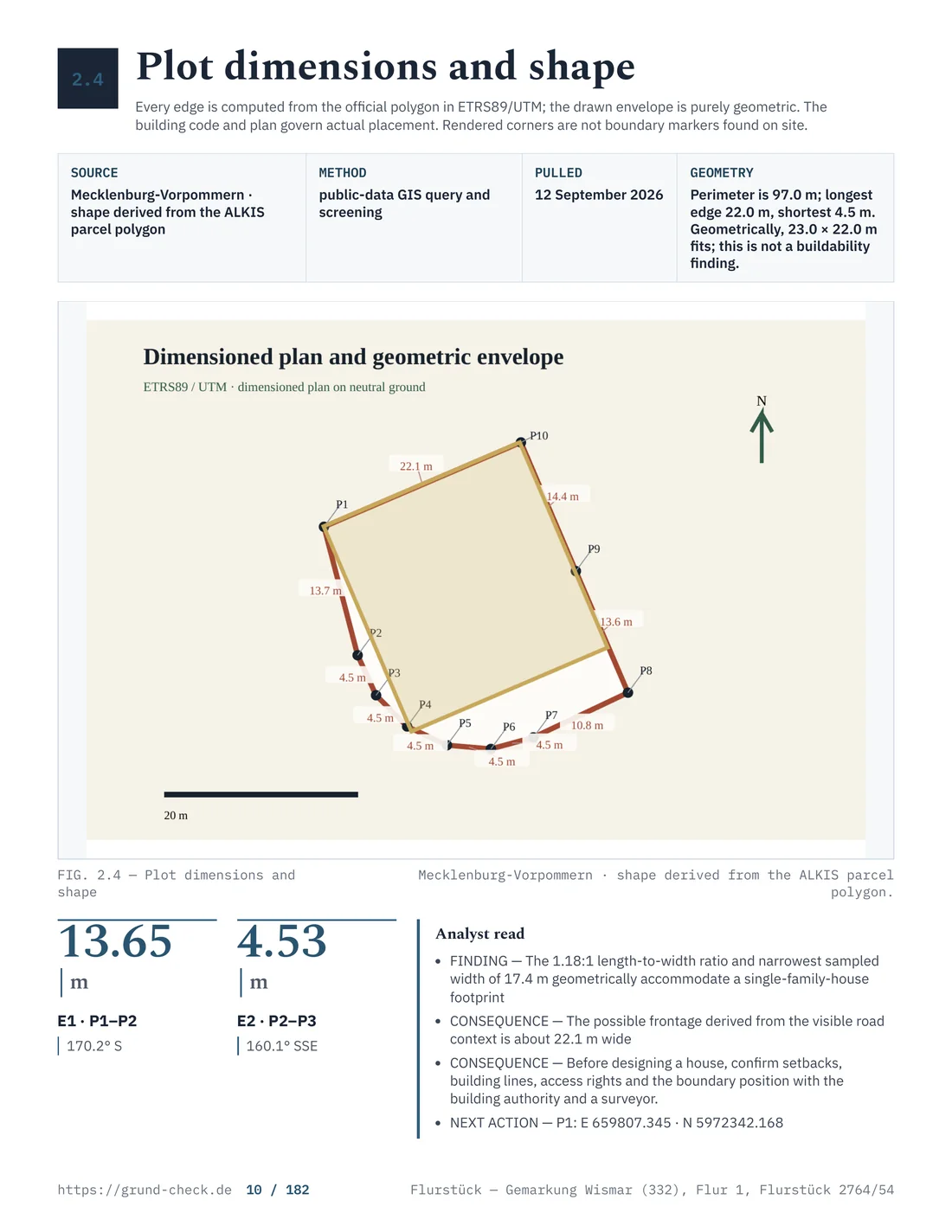
On site, the new boundary points are determined and marked permanently, usually with boundary stones or metal markers. The new parcels receive their own numbers in the land cadastre, and the result is documented as an update record (Fortführungsnachweis). The boundaries and survey guide describes the technical steps of boundary determination in detail.
The surveying office generally invites the owners of the neighbouring parcels to the boundary appointment too, because the newly drawn line affects their land as well. Failing to attend usually does not stop the survey, but it does mean losing the chance to raise objections on the spot rather than filing a formal complaint with the cadastral authority afterwards.
From the cadastre to the land register
The land register can only act once the new boundary line is fixed in the cadastre. § 2 Abs. 3 GBO is the decisive rule here: a part of a plot may only be written off from it if the part is carried in the official register under its own number, or if the authority responsible for the cadastre certifies that it waives this requirement because the part is being merged with a neighbouring parcel.
In practice this means no land registry will carry out a division without a completed split in the cadastre. The order, survey before land register, cannot be reversed. The new parcel gets its own running number in the register of holdings, either on a new land register sheet or, where it is merged with a neighbouring area, as an addition to an existing sheet.
When a divided part is to be sold right away
The division itself is not yet a sale. Where the new part is transferred to a third party, that step needs the notarial form under § 311b BGB and the conveyance under § 925 BGB, exactly like any other land purchase. In practice the survey and the purchase contract are often organised in parallel: the notary certifies the sale of an area not yet finally delineated, referring to a site plan, and the final parcel description is added once the update record is available.
The notary appointment itself does not differ from an ordinary land purchase; it is described in detail in the notary process and closing guide.
Where the area assumed in the purchase contract later differs from the final survey result, the contract should settle from the outset how such a difference changes the purchase price. A common clause fixes a price per square metre and lets deviations up to a set minor threshold pass without consequence, while larger deviations are settled proportionally.
Utility connection and contributions after division
A new parcel often brings a new cost question with it. Where the divided area does not yet border a finally completed utility connection, its own connection contribution can arise under §§ 127 and § 133 BauGB once the facility is finished. The access and infrastructure guide explains how these contributions are calculated.
Property tax is also reassigned after a division. The tax office has to split the property tax value across the new parcels before the municipality can apply its own rate to each area. Until that split exists, the old assessment often stays in place on a transitional basis.
Minimum sizes and the practical limits of divisibility
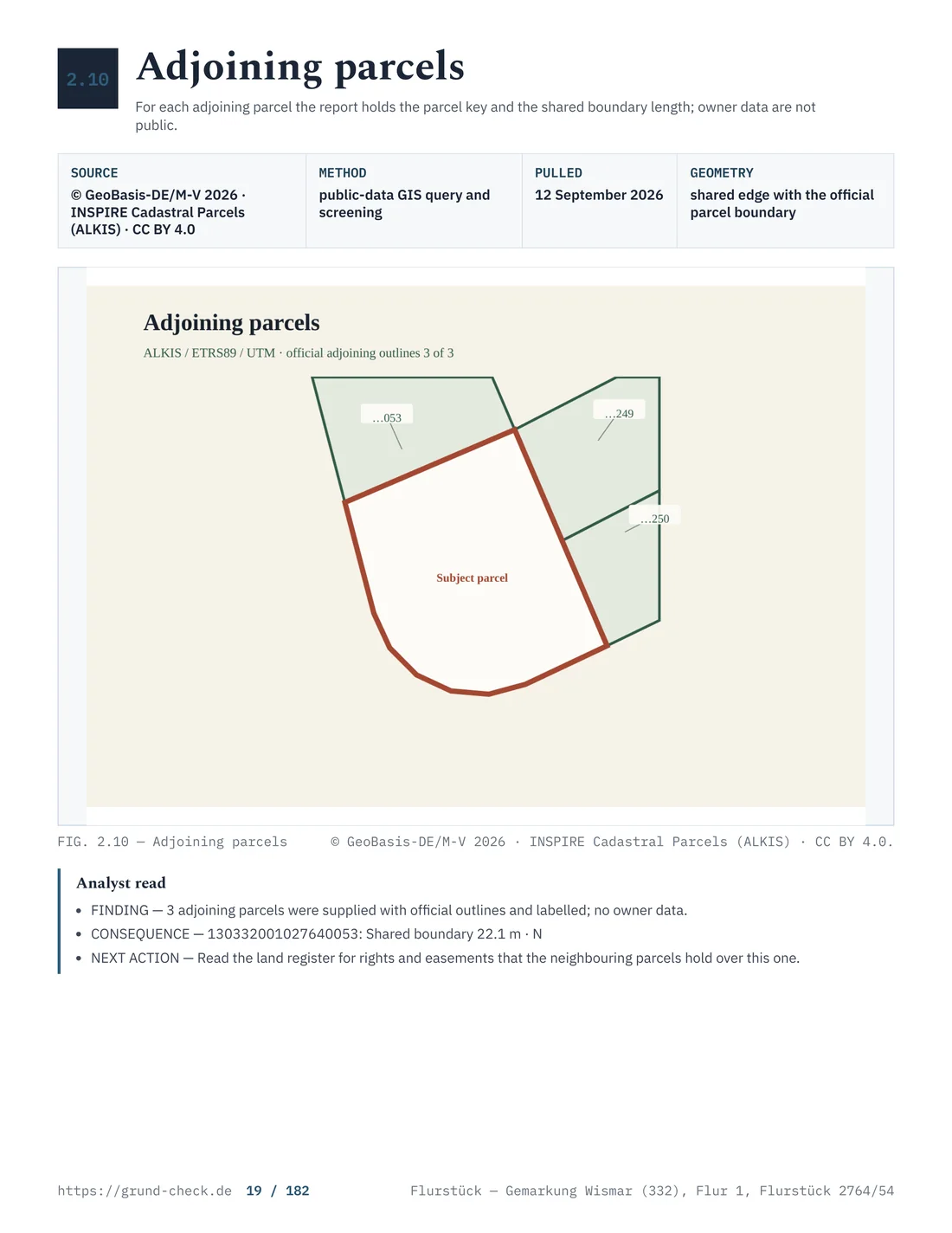
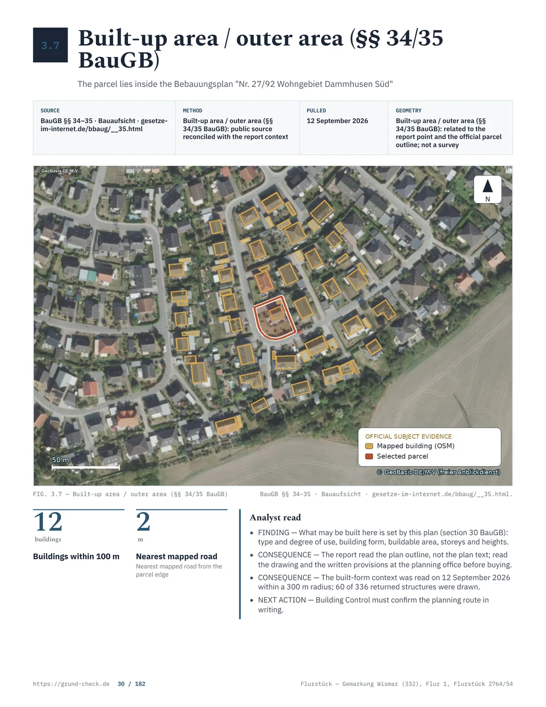
There is no nationwide minimum size for building plots. Whether a newly created area stays buildable at all depends on the provisions of the development plan, for instance the site coverage ratio, or, outside a plan, on § 34 BauGB and the immediate surroundings. How deep the setback to the new boundary has to be, by contrast, is set by each state in its own building code; a remaining area cut too narrow can fail on this point even where the development plan itself sets no minimum size.
Anyone dividing a plot in order to build on one of the resulting areas should therefore check, before commissioning a survey, whether a building with the required setbacks actually fits on the intended remaining area. The zoning and buildability guide sets out these questions.
Value per square metre also does not automatically shift in the same proportion through a division. A small, awkwardly cut remaining area can be worth less per square metre than the undivided starting parcel, while a new, well-connected building plot can reach the local reference land value. The land value guide explains how that official figure is determined.
Trees and hedges at the new boundary
A survey does not happen in a legal vacuum. Where a hedge or a stand of larger trees sits on the planned boundary line, cutting back or clearing it triggers § 39 BNatSchG: hedges, shrubs and other woody growth may not be cut, coppiced or removed between 1 March and 30 September. That has no bearing on the boundary determination itself, but it matters a great deal for clearing the area afterwards.
Where a legally protected biotope is involved, § 30 BNatSchG also comes into play; an intervention can then need an exception or exemption even outside the closed season. A forest parcel carries further particulars, summarised in the buying forest land guide.
Survey costs and who pays them
Who pays for the survey is initially a matter for the parties to agree, though it is usually the owner who wants the division. The amount follows the fee schedule of the relevant state for its surveying administration or, where a publicly appointed surveyor is used, that surveyor's own fee schedule approved under state law. Both routes are common nationwide, but the actual cost structure differs from state to state.
On top of the pure survey cost come possible follow-on costs: a notarial deed where part of the area is sold, and the property tax reassignment already mentioned. The costs and taxes guide gives a rough sense of the usual extra costs around a land purchase.
Building obligations and easements affected by division
A division can move existing rights into a new position. A building obligation that originally applied to the whole plot needs reassigning once the relevant area belongs to two separate parcels. The same applies to a registered right of way or a utility easement: where the new boundary runs through the middle of the benefited or burdened area, the register entry has to be adjusted or newly created accordingly.
This adjustment does not happen automatically with the survey. Anyone separating a part without a secured access of its own creates a parcel that can, in practice, only be connected through a newly created easement. The details are set out in the easements and rights of way guide.
What differs between states
The line between federal law and state law is drawn clearly for a division. The concept of a division, the blocking effect within a development plan area and the notarial form of a subsequent sale are all federal law, sitting in the BauGB and the BGB, and apply the same way everywhere.
How the survey is organised, who is allowed to carry it out and what an update record costs, by contrast, is decided by each state in its own surveying and cadastral act. Some states leave the split exclusively to the state surveying administration, while others hand most of it to publicly appointed surveyors working independently.
A nationwide overview of the geoportals and cadastral access points across the states is being prepared as a separate comparison page; until then, the boundaries and survey guide sets out the main differences.
The process at a glance
| Step | Responsible | Result |
|---|---|---|
| Application for the split | state surveying office or public surveyor | instruction to determine boundaries |
| Boundary appointment and marking | surveying engineer | new boundary points on the ground |
| Cadastral update | state cadastral authority | new parcel numbers, update record |
| Check of the blocking effect | municipal building authority | confirmation or refusal under § 19 Abs. 2 BauGB |
| GrdstVG approval, where relevant | agricultural authority | approval within one to three months |
| Write-off in the land register | land registry | new or amended land register sheet |
| Property tax reassignment | tax office, municipality | separate assessments per parcel |
- Ordinary building plotSurvey, cadastral update and land register
- Agricultural landCheck the additional GrdstVG approval
- Sell the part immediatelyCoordinate the deed with the new parcels
Source: State surveying and cadastral acts, GBO and GrdstVG; checked August 2026
Common mistakes when dividing a plot
- The survey is commissioned before the municipality has confirmed that the split fits the development plan.
- On agricultural land, the GrdstVG approval requirement is missed because it is confused with building law.
- An existing building obligation or easement is not adjusted to the new boundary.
- The remaining area is cut so narrow that the setbacks in the state building code effectively rule out later construction.
- A purchase contract is notarised over an area not yet carried in the cadastre, without settling the later adjustment in the contract.
Check the remaining area before you commission anything. A GrundCheck report brings together planning rules, setbacks and charges for a parcel, so a division does not fail on an overlooked detail. Check a parcel.
Division as a way out of a community of heirs
A common reason for a division is a community of heirs that cannot agree on a joint sale. § 752 BGB names division in kind as one way to dissolve a community, provided the shared item can be split into similar parts corresponding to the shares without loss of value. For a plot this means: the heirs have it divided by survey and each then takes over their own parcel, instead of splitting the proceeds of a joint sale.
That requires the division to actually produce parcels of equal value, building to remain permitted on each new area, and all co-heirs to agree to the split. Where that cannot be achieved, the only statutory route left is an auction under § 753 BGB, addressed in the notary process guide in connection with the subsequent sale.
Merging plots as the counterpart to division
The reverse case also occurs: two neighbouring plots are to become one, for example to create a larger building plot. That, too, needs a cadastral clarification first; the merger then happens in the land register as a consolidation or an addition to an existing sheet. § 2 Abs. 3 GBO addresses this case expressly, in the part where it waives the separate booking of a split-off part because it is being combined with a neighbouring parcel.
A merger often pays off economically where two small remaining areas would not be buildable on their own but together meet the state building code's minimum requirements for setbacks and access. As with a division, the rule holds: first the update in the cadastre, then the change in the land register.
What to settle before applying
Unresolved questions about access, planning status or burdens can delay a division before or after the survey. A short list at the start keeps those issues visible and can avoid additional work later.
- The district, section and parcel number of the existing area, so the application is unambiguous.
- Written confirmation from the municipality on compatibility with the development plan, or the classification under § 34 BauGB.
- Whether the area is used for agriculture or forestry and can therefore fall under the GrdstVG.
- Existing building obligations, easements and mortgages that the new boundary would affect.
- The intended access to each new part and how it will be legally secured.
Legal basis and sources
- Concept and blocking effect of a division: § 19 and § 20 BauGB.
- Utility contributions: § 127 and § 133 BauGB.
- Land register and cadastre: § 2 GBO.
- State authority: Art. 70 GG.
- Agricultural structure: § 1, § 2, § 4 and § 6 GrdstVG.
- Contract form: § 311b and § 925 BGB.
- Community of heirs: § 752 BGB.
- Nature conservation: § 30 and § 39 BNatSchG.
Rules and figures were checked in August 2026. This information is general in nature and not legal advice for a particular plot.
Read next: boundaries and survey, land register and ALKIS and costs and taxes.
A new boundary raises a neighbour-law question straight away: boundary planting and fences.